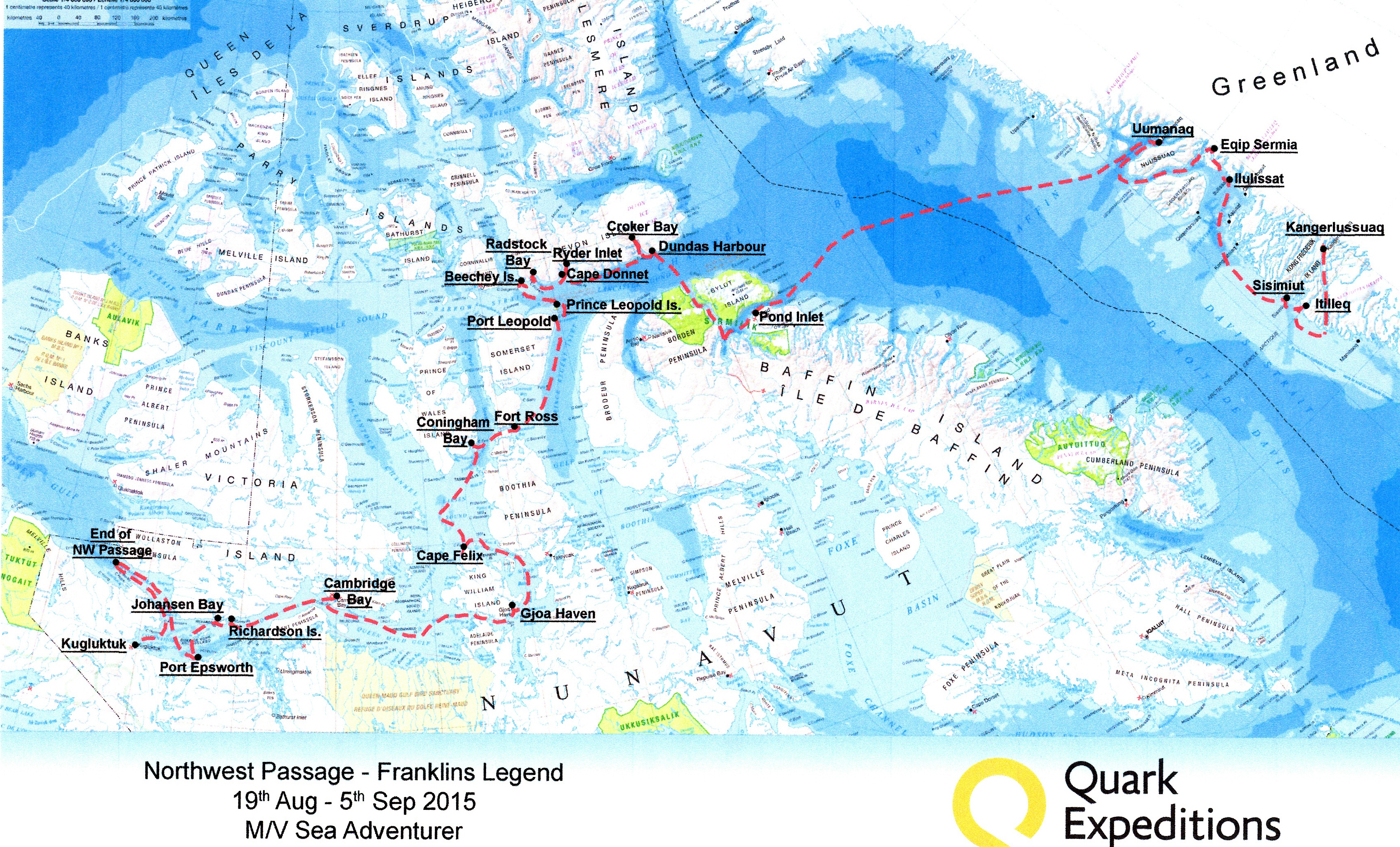
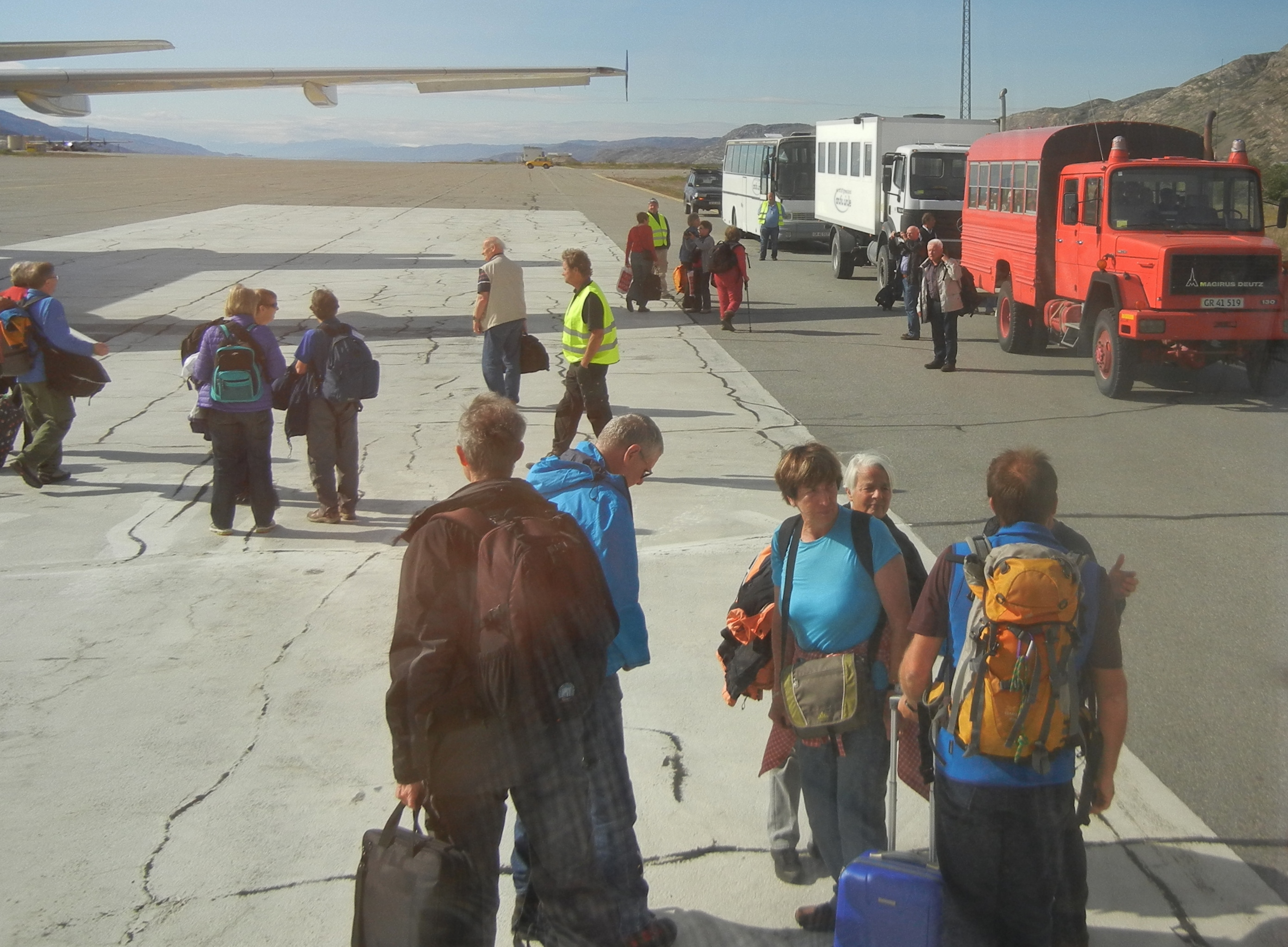
We begin with a flight from Copenhagen. We land at Kangerlussaq, a small airport and harbour at the head of a long fjord in SW Greenland. Greenland is about the size of Western Australia. We are loaded into FWD busses, while our luggage is being transferred to our ship, and are driven up into the Ice Field which covers 90% of the country and is up to 4000 mts. deep, an average of 2800 mts. Can you imagine that much ice covering WA?
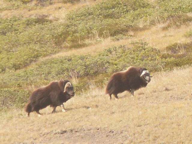
This is a 3 hour trip with lunch, in a paper bag. On the way we see Musk Oxen grazing on the green Tundra.
These were the only ones we would see on the whole trip even though there are thousands of them in the northern latitudes. We are soon at the edge of the ice field with cold wind blowing off the ice. Our first introduction to ice was before us.
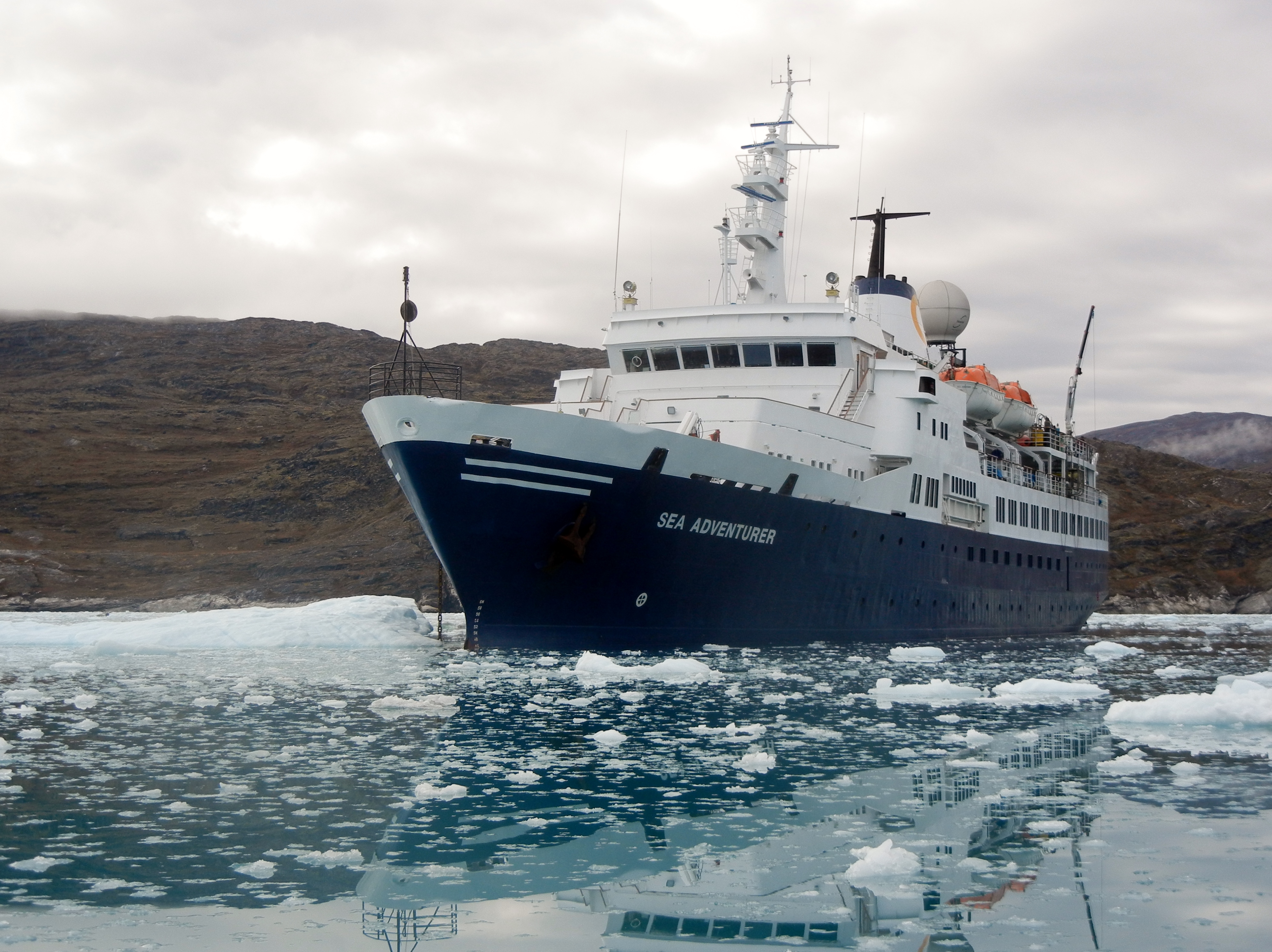
Back to the Port where we are ferried to m/v Sea Adventurer by Zodiac.
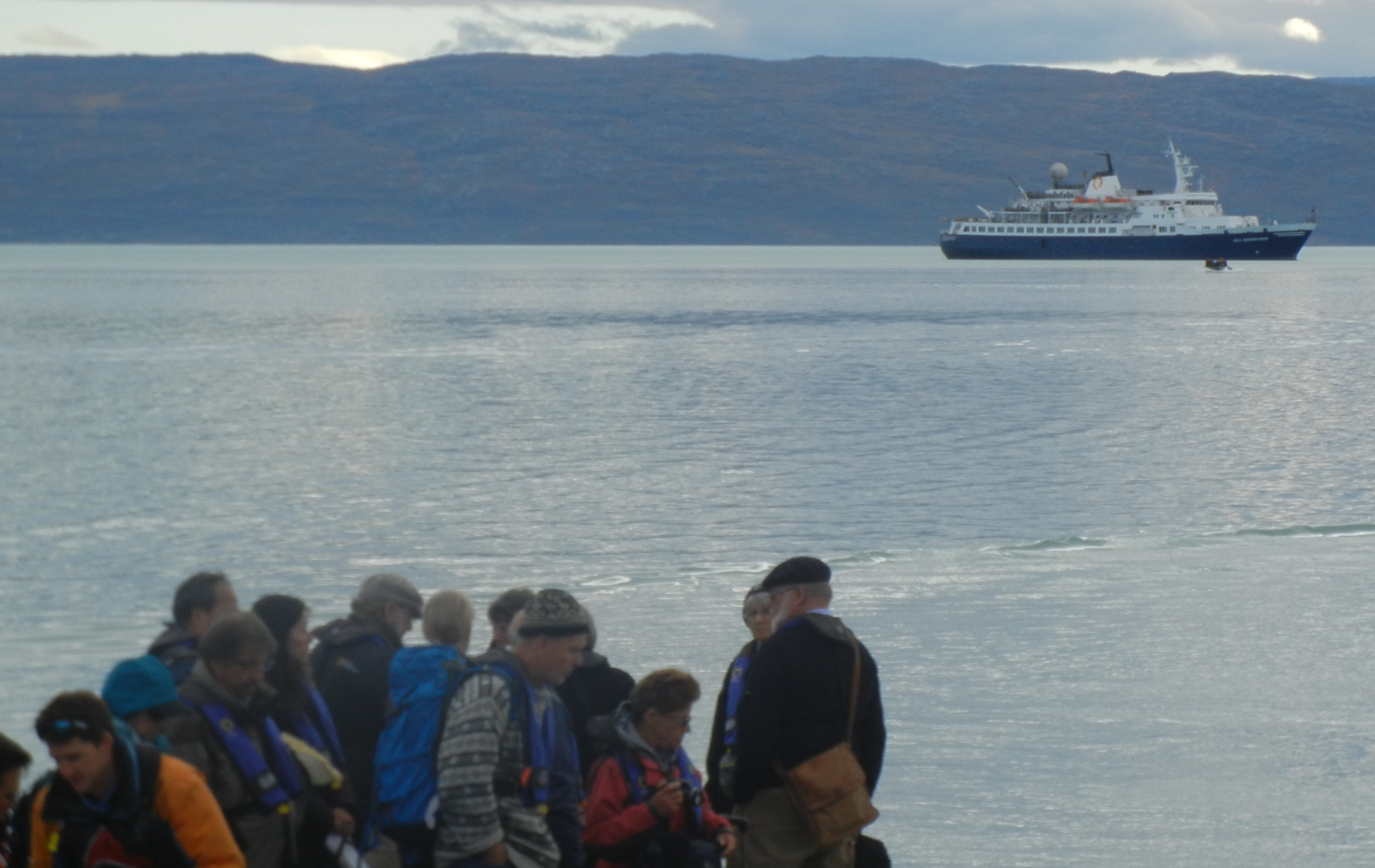
We are on our way immediately after all the mandatory drills.
Day Two:
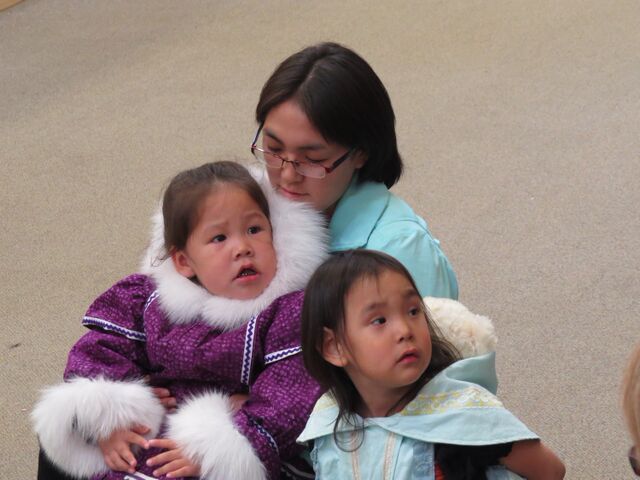
We have 2 landings, first the little village of Itilleq where there were 2 open houses to have tea and biscuits. Interesting to see how they live.
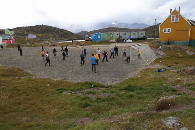
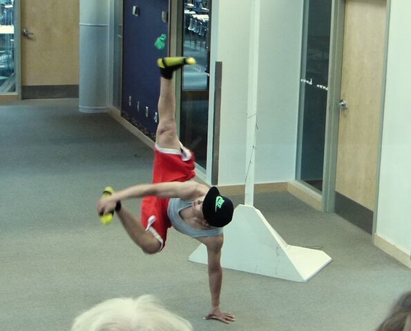
“We” played soccer on a dry dusty, gravel square and were beaten by the locals.
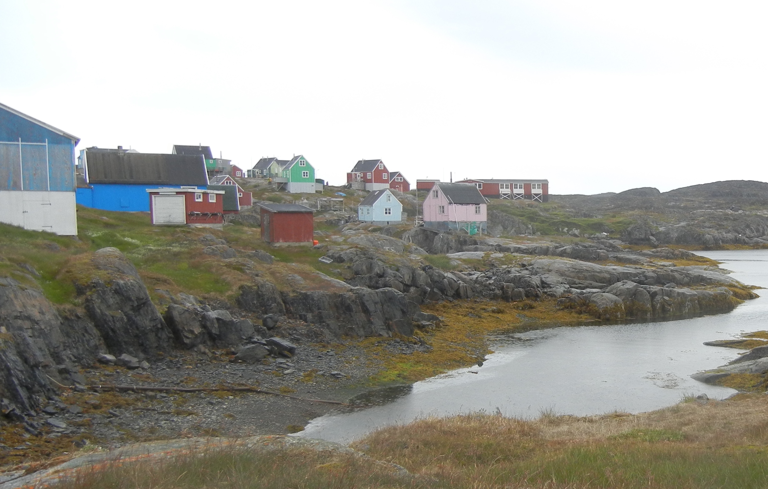
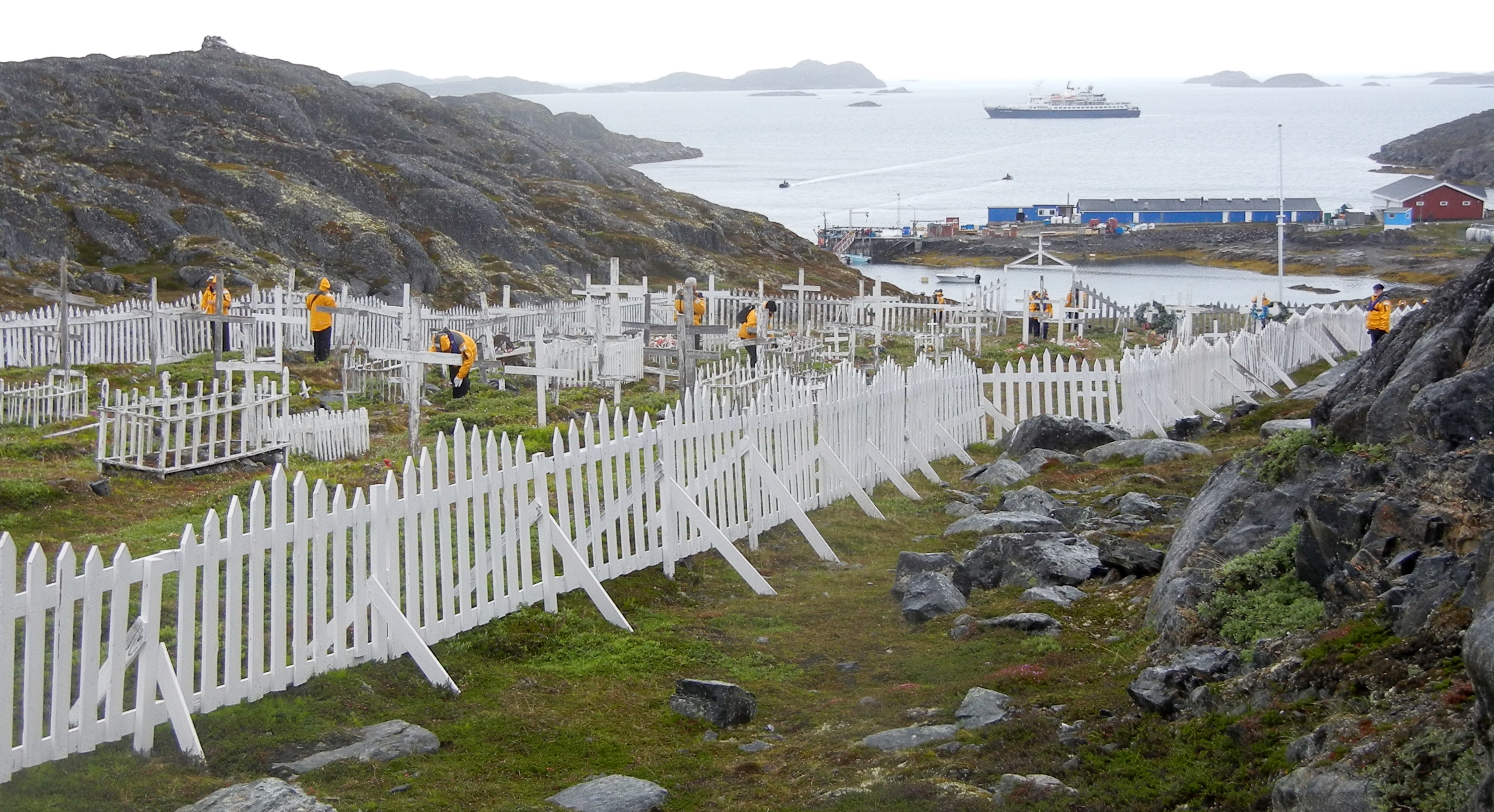
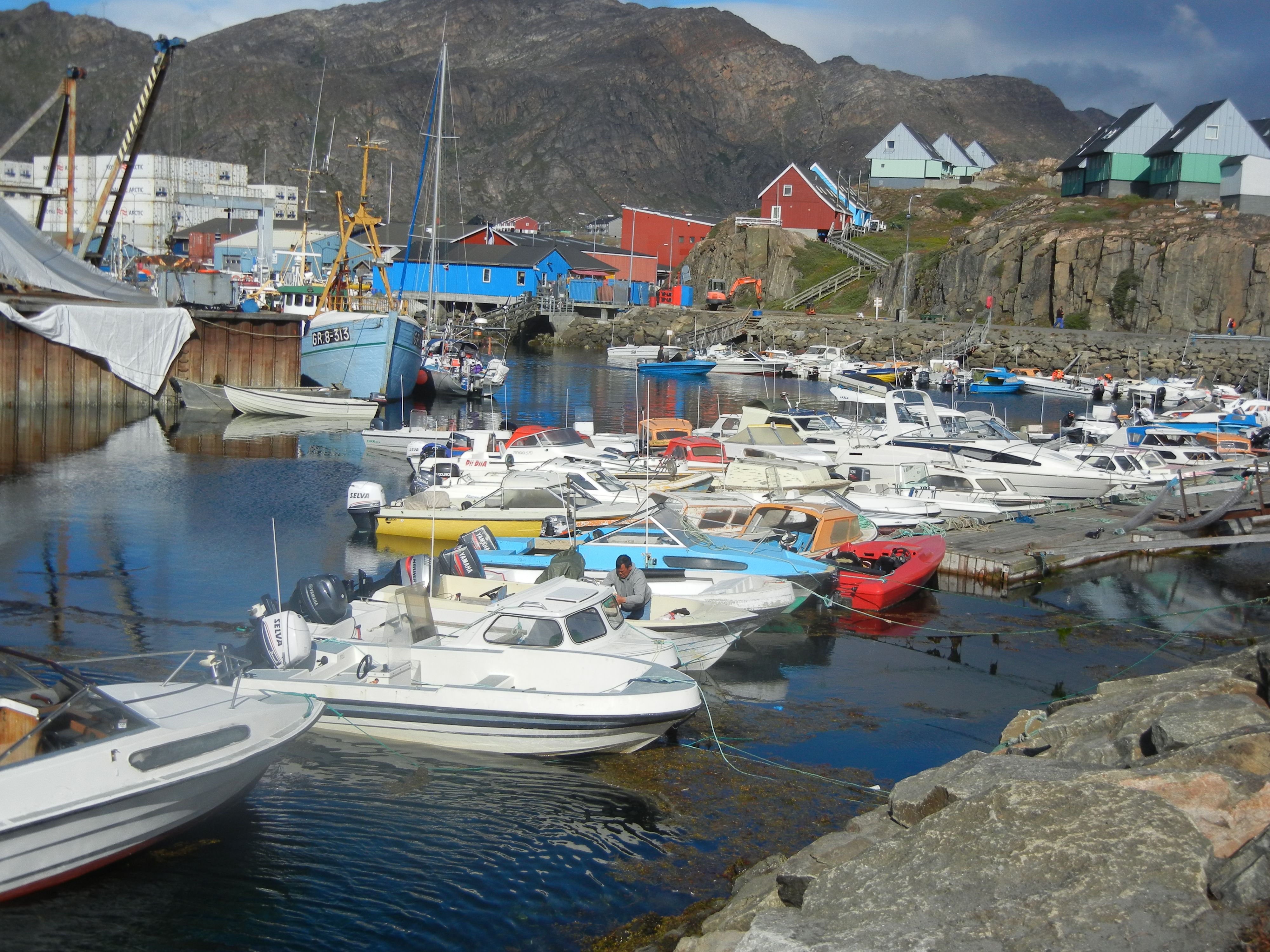
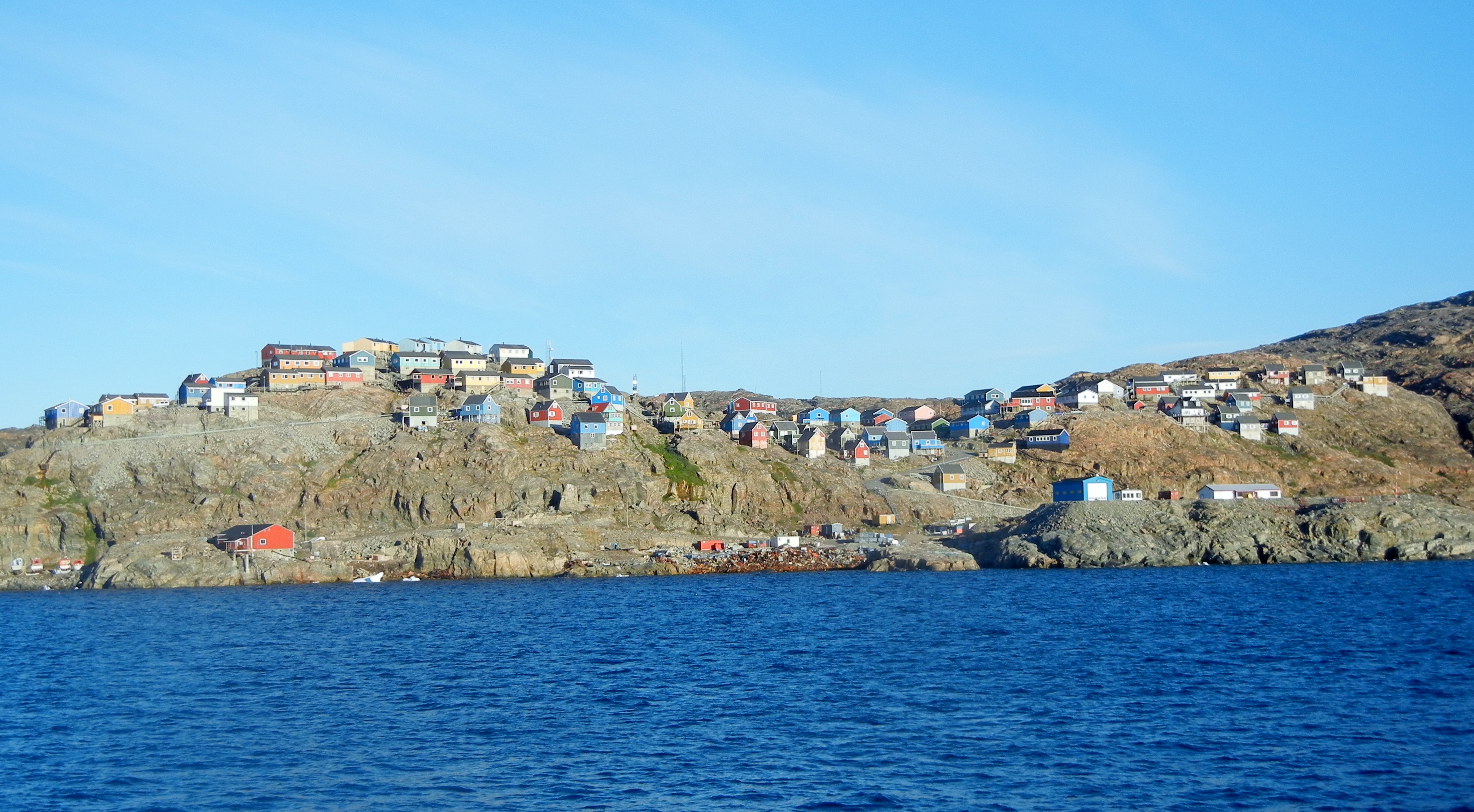
Next town Sisimuit Pop. 6000. A 2 hour guided tour by the locals covered the library. an interesting museum, the schools, churches and a very sustantial public hall. Second largest town in Greenland but very much a fishing village. We are now 75km north of the Arctic Circle. This is Greenland’s most northerly ice free port. Dutch whalers and traders arrived here in the 17th century.
Captain’s welcome cocktails tonight.
Day 3:
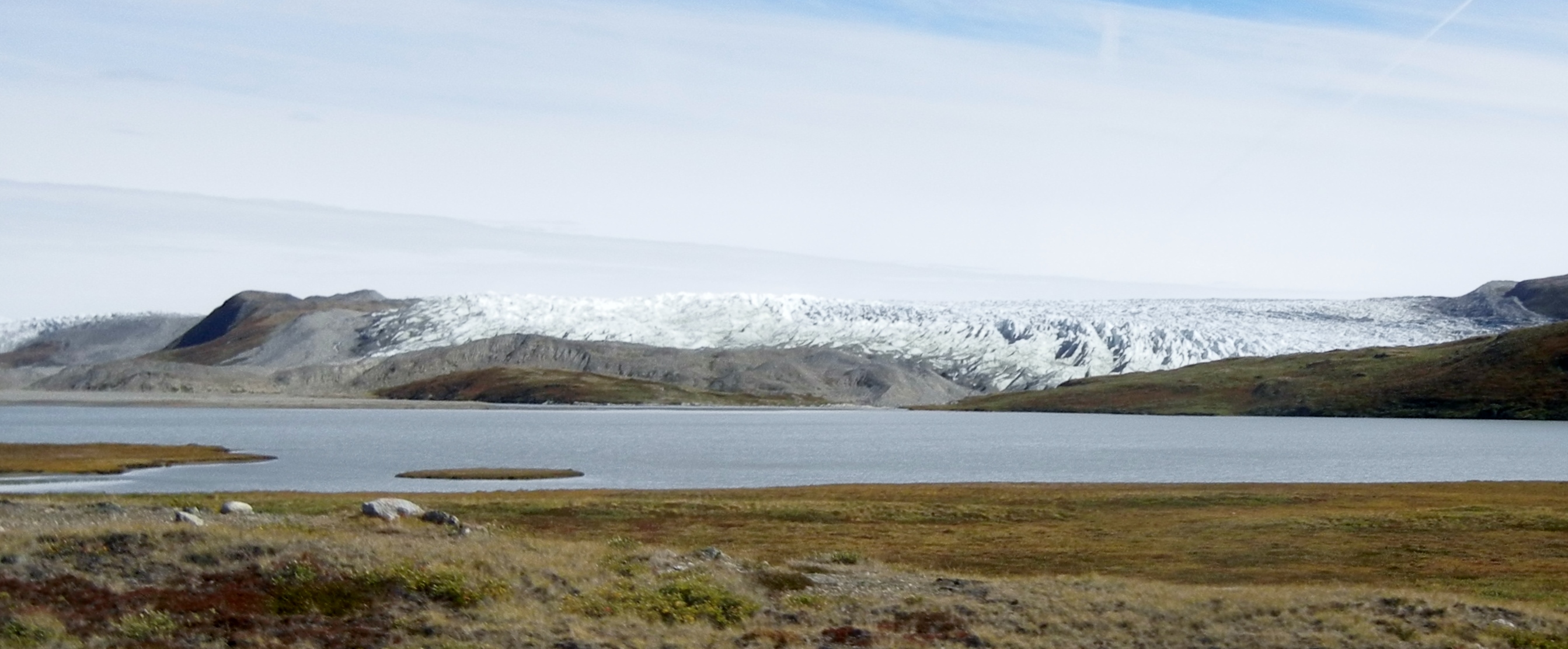
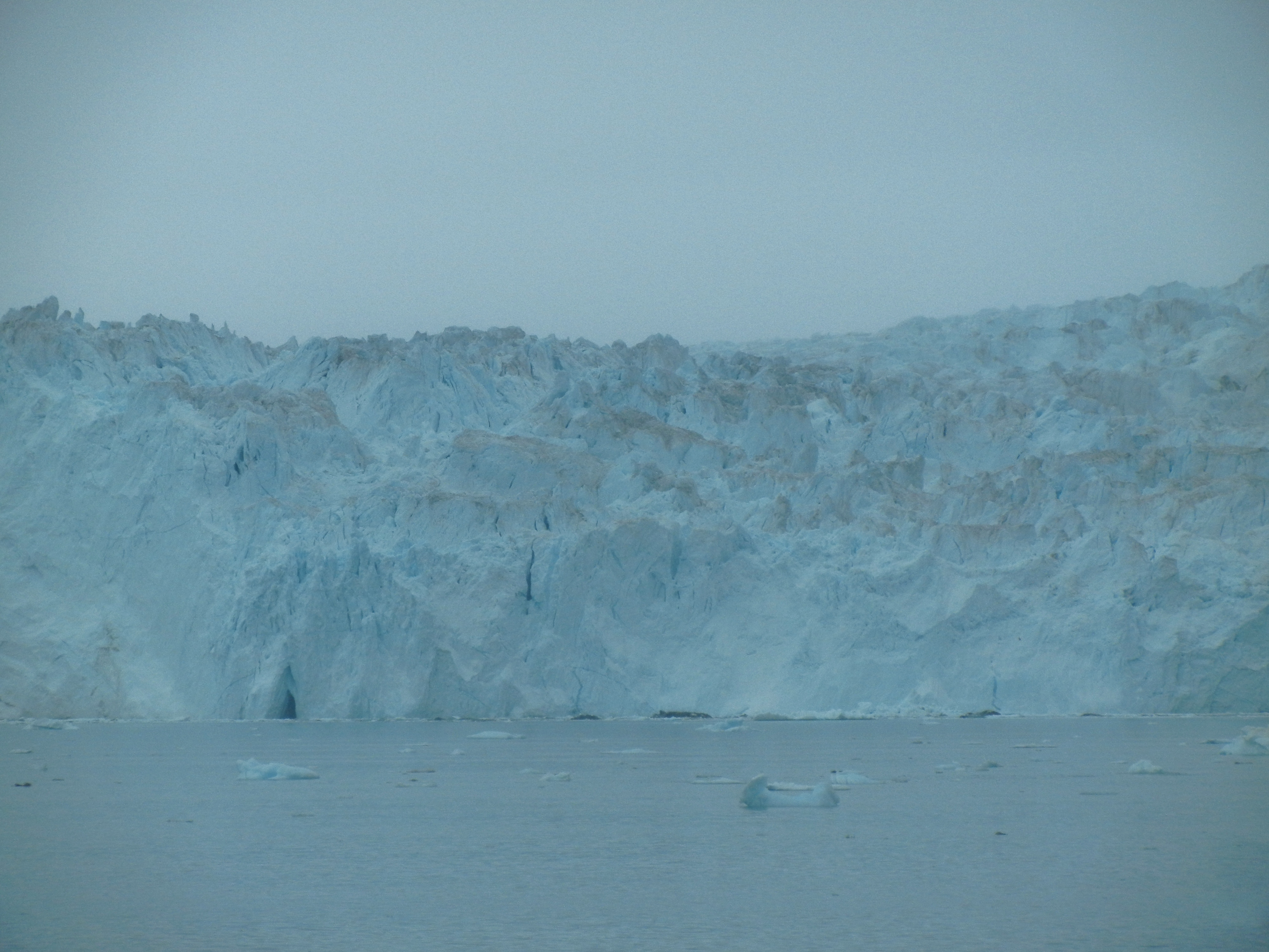
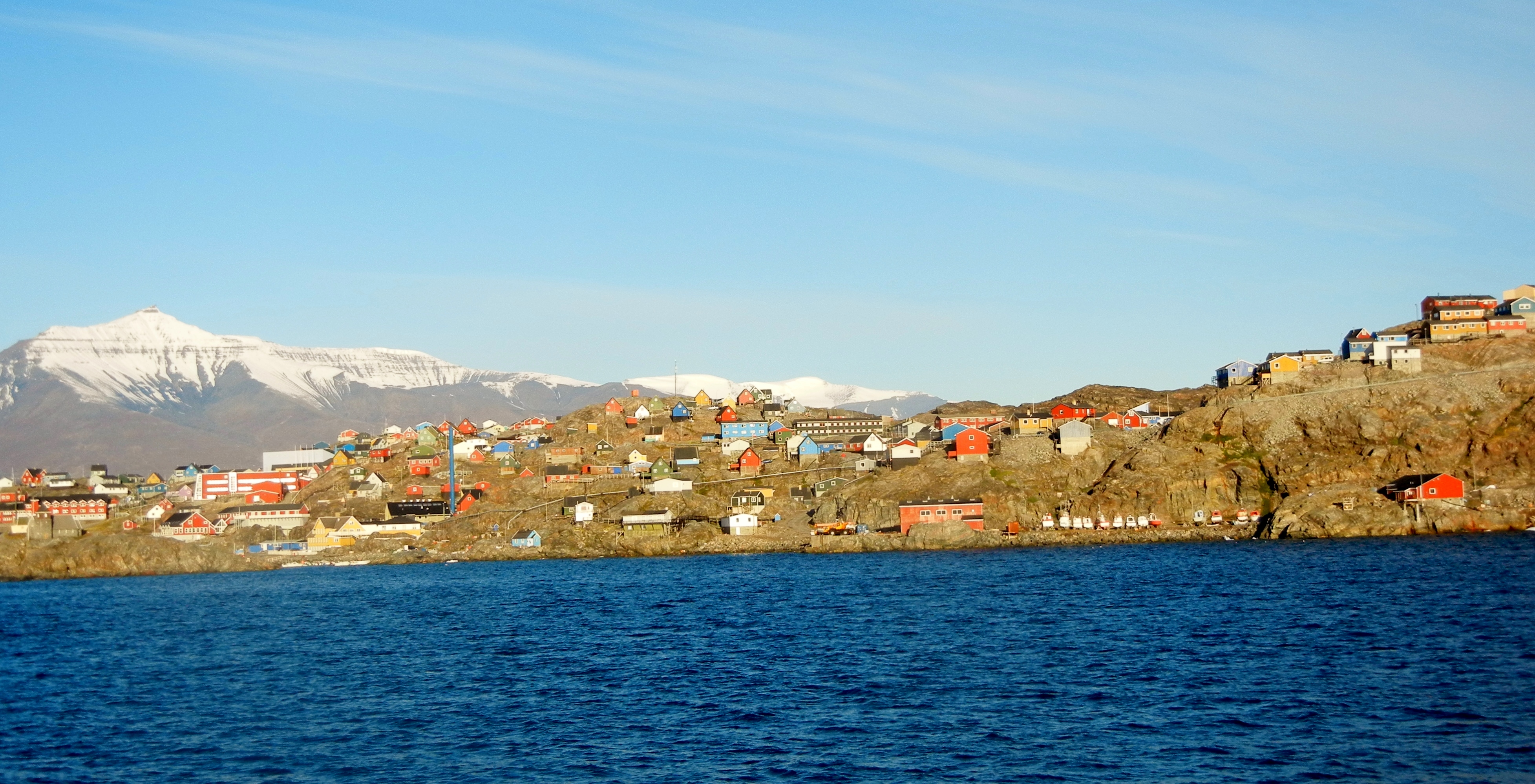
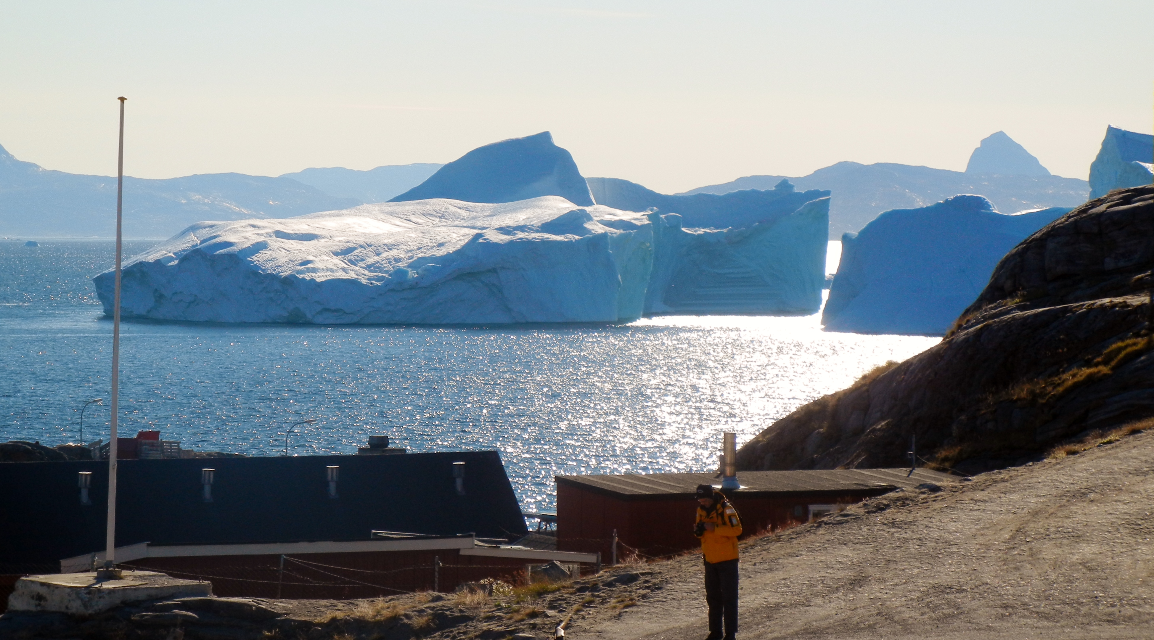
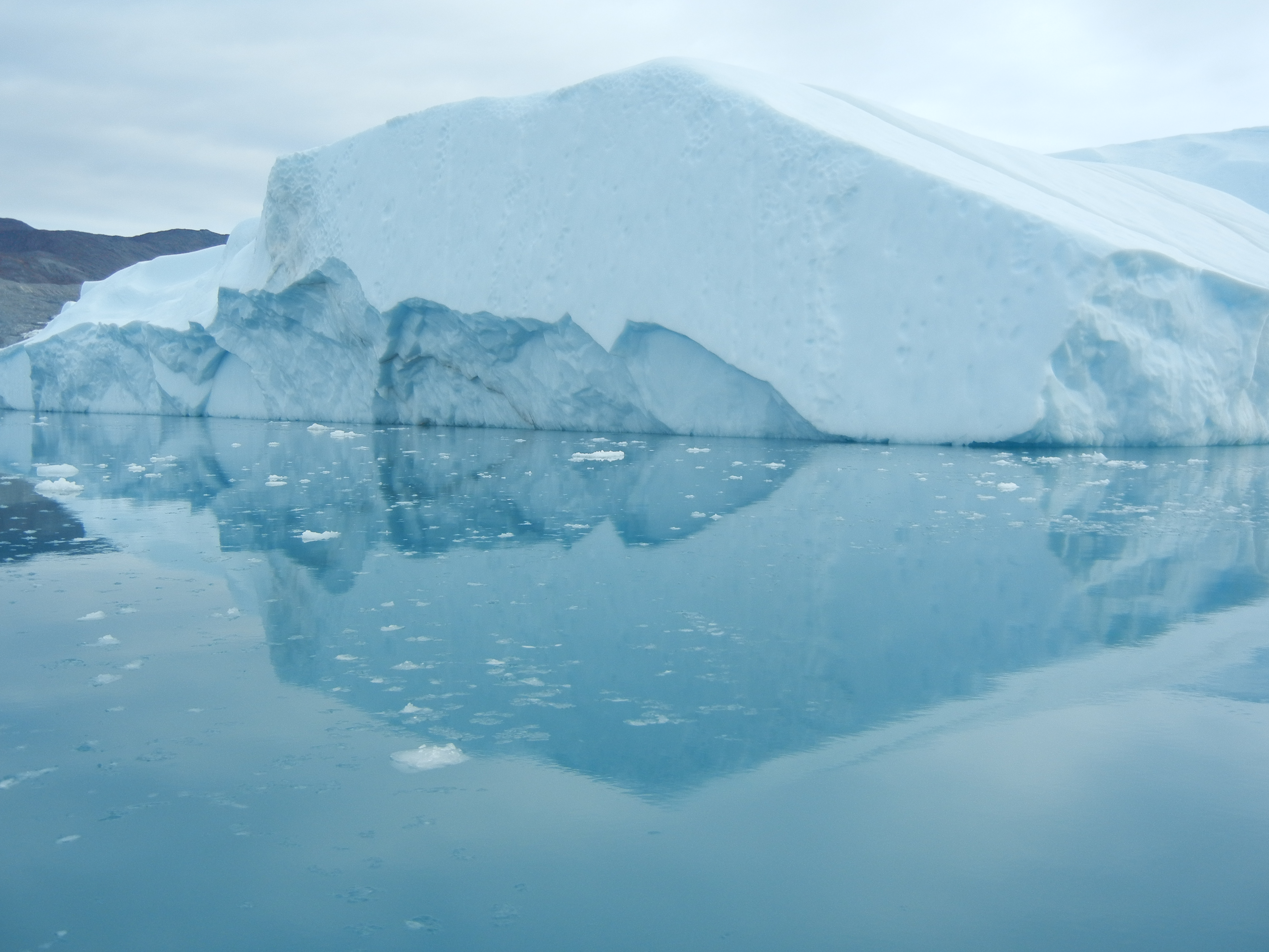
Ilulissat pop.4500 and Jakobshavn Glacier. 350 km north arctic circle.
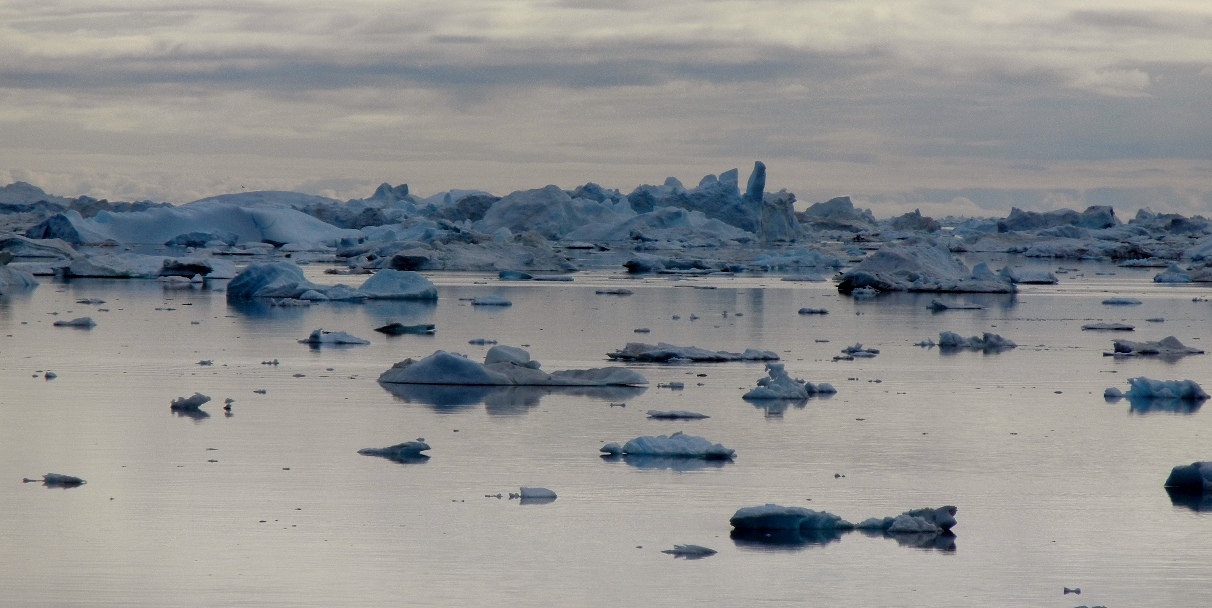
Ilulissat is at the mouth of 40 km long ice fjord that produces several million tonnes of ice per day, and chunks that break off can produce tidal waves up to ten meters high. We saw a video of such a wave wrecking boats in the local harbour.
Ilulssat, directly translated means Iceberg.
Jakobshavn Glacier drains 6.5% of the Greenland ice sheet and produces 10% of all the Greenland icebergs. 35 billion tonnes of icebergs calve off and pass out the fjord every year.
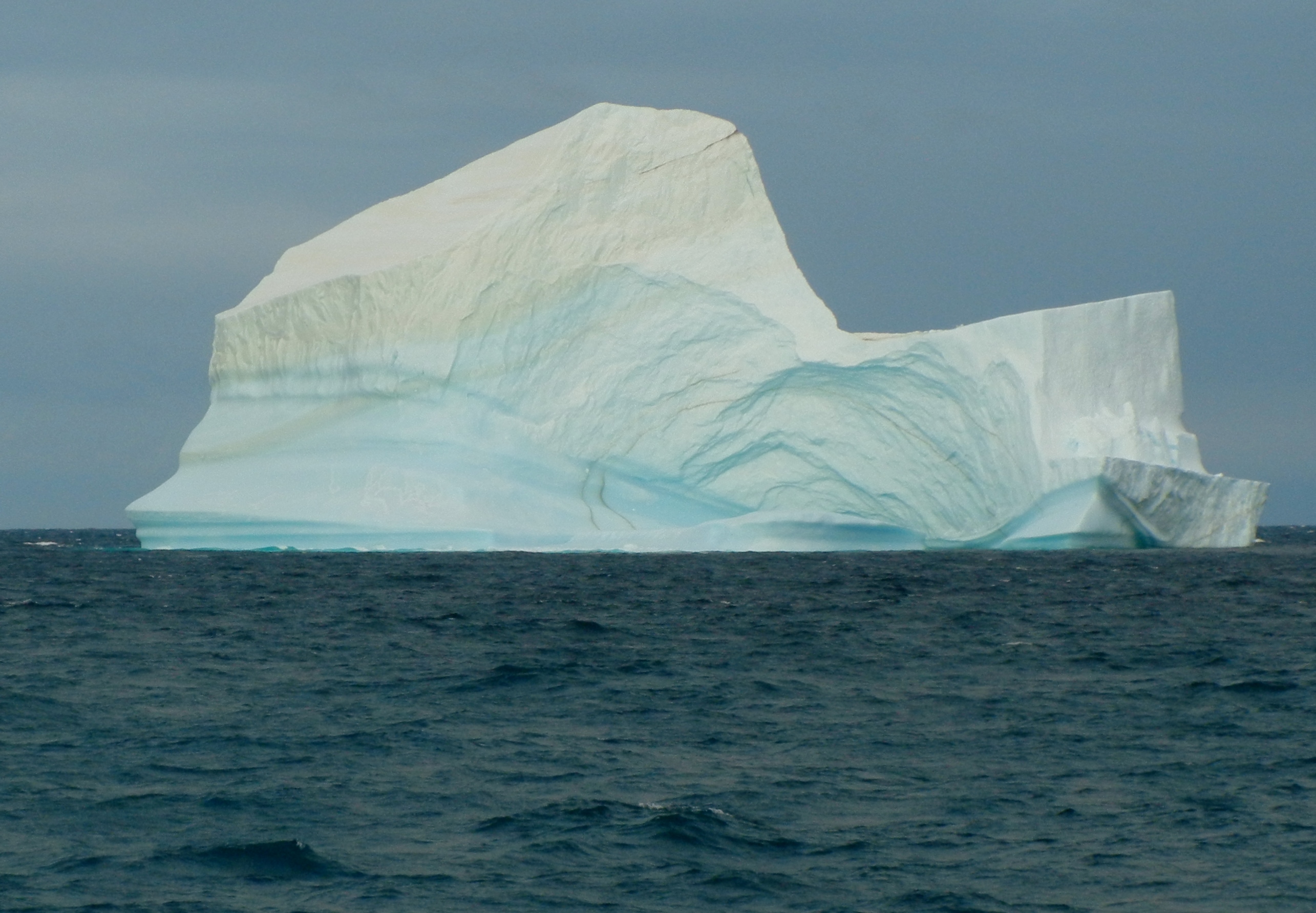
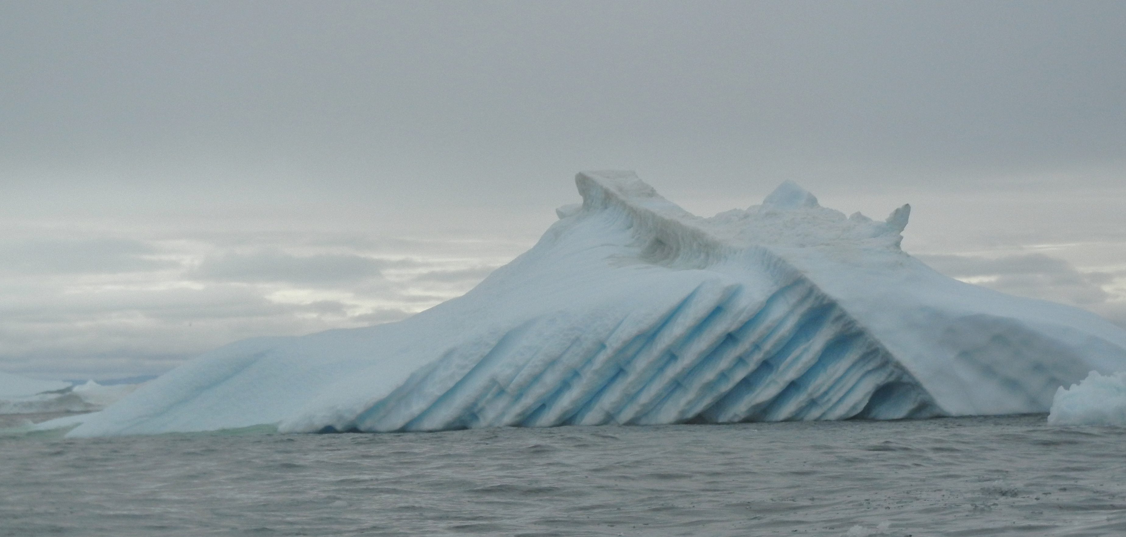
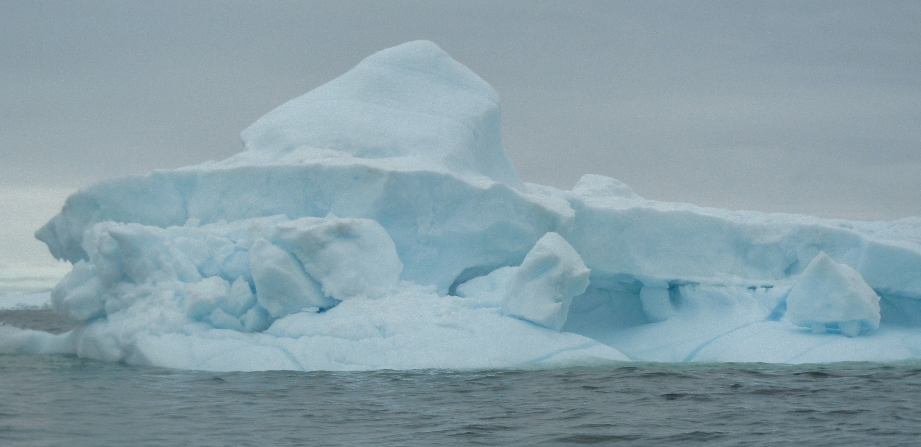
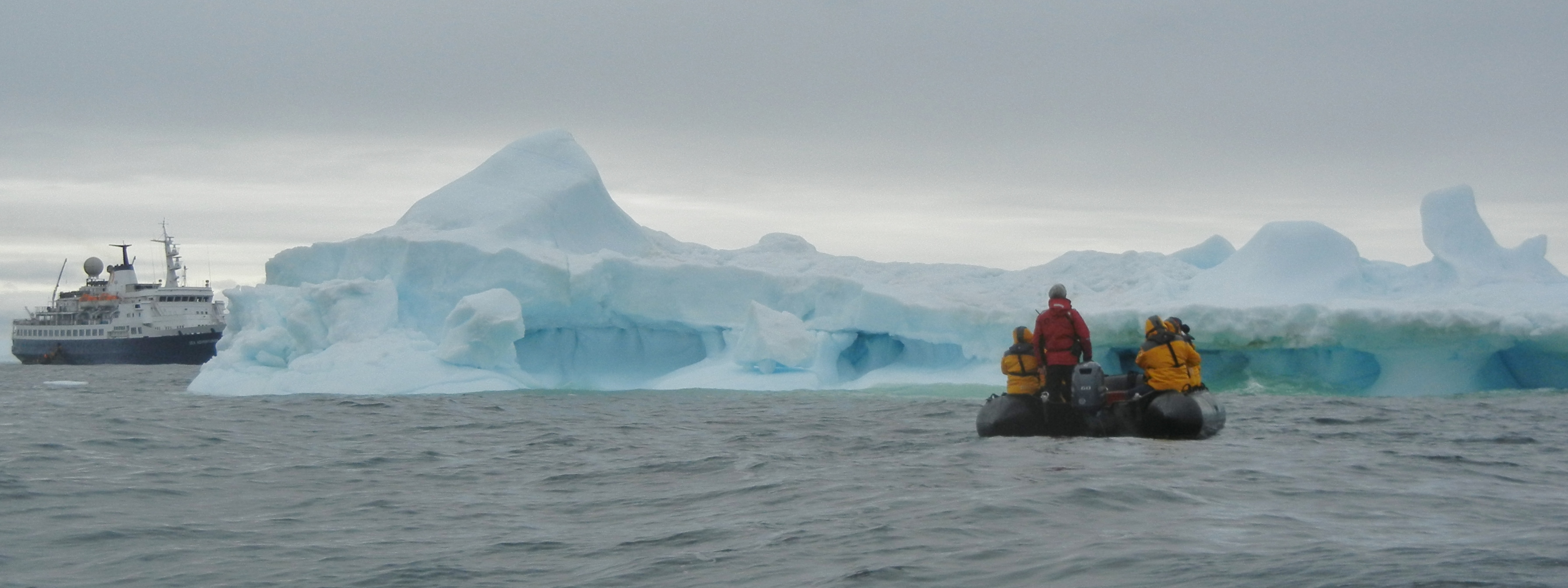
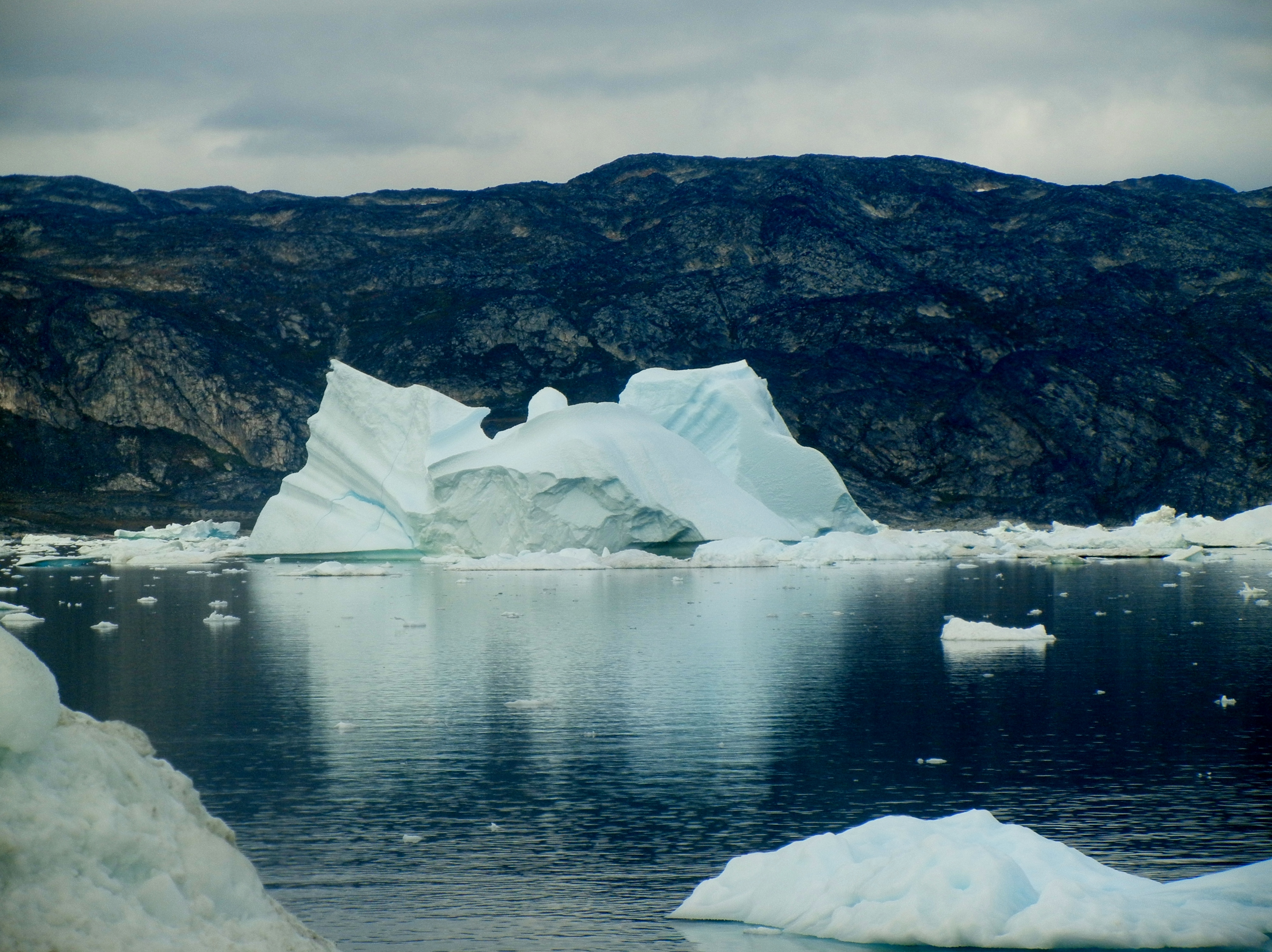
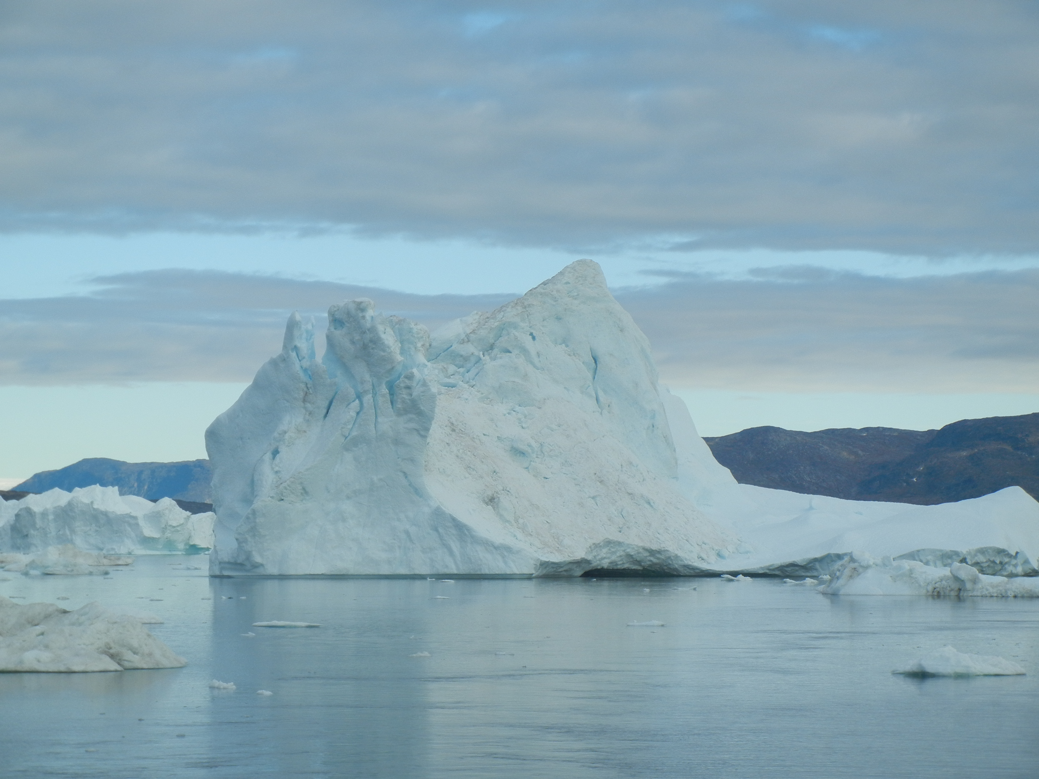
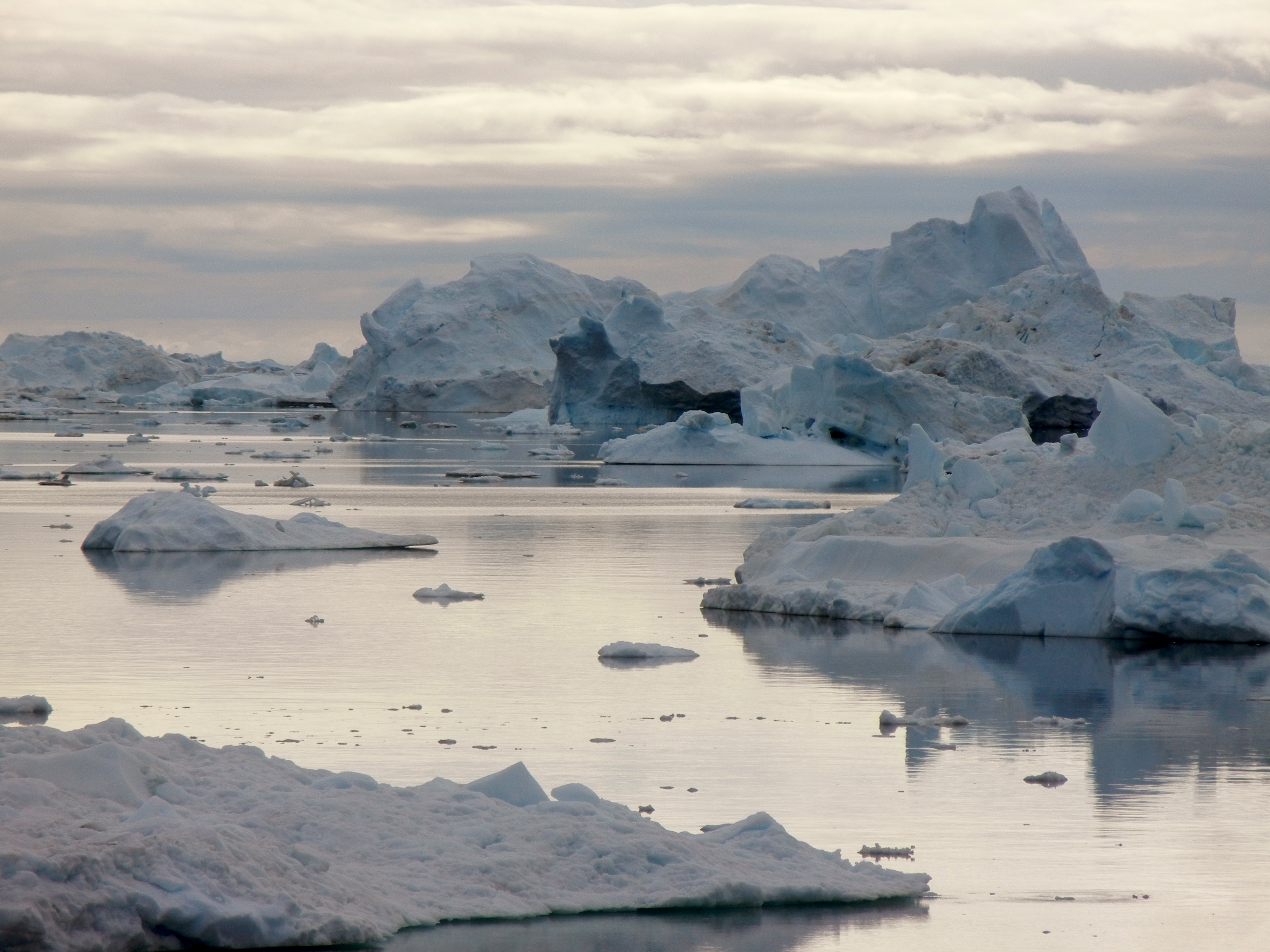
At times the large icebergs become grounded, sometimes for years until they are broken down by weather and tides or other icebergs crashing into them.
Day 4: A Typical day 500km north of the Arctic circle.
0645 Early morning tea, coffee and pastries available in the lounge
0700 Wake up call
0730 Breakfast is served in the dinning room
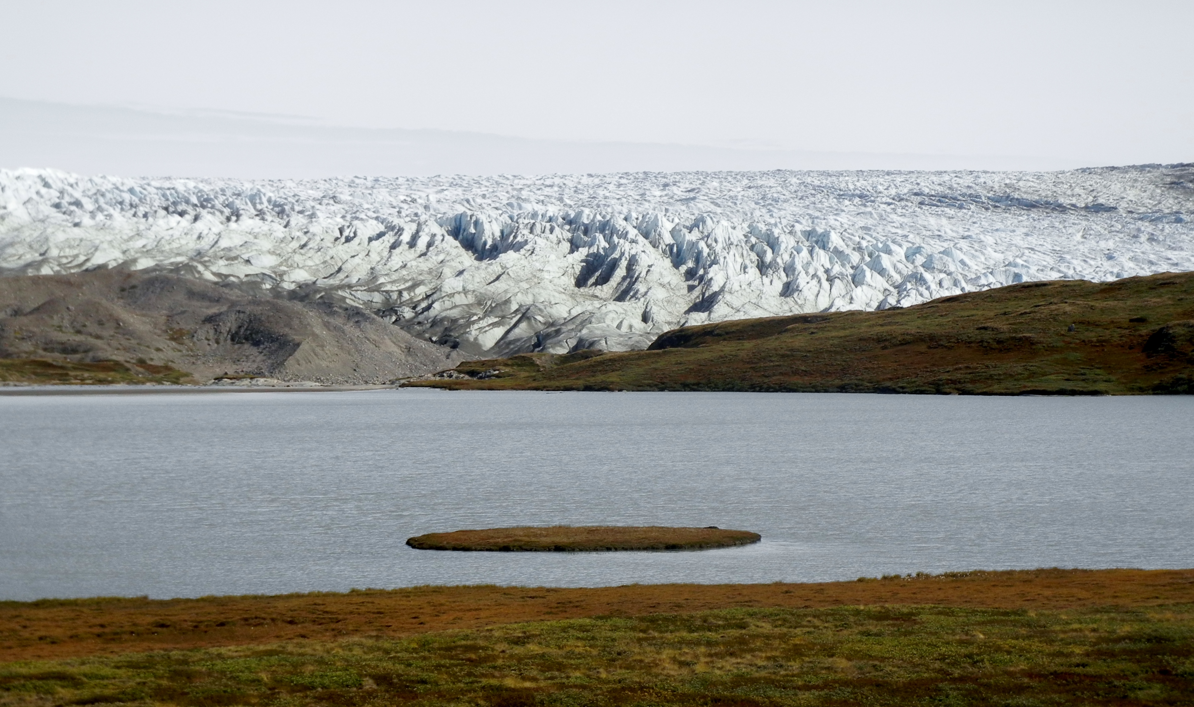
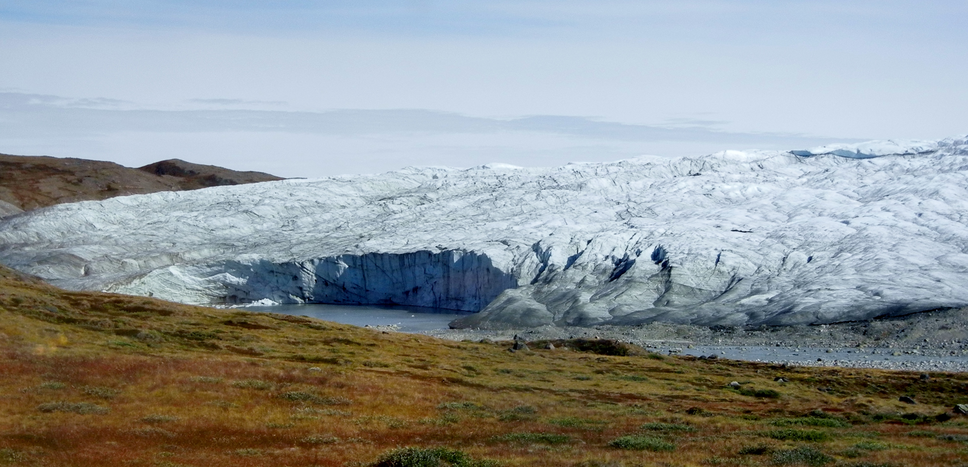
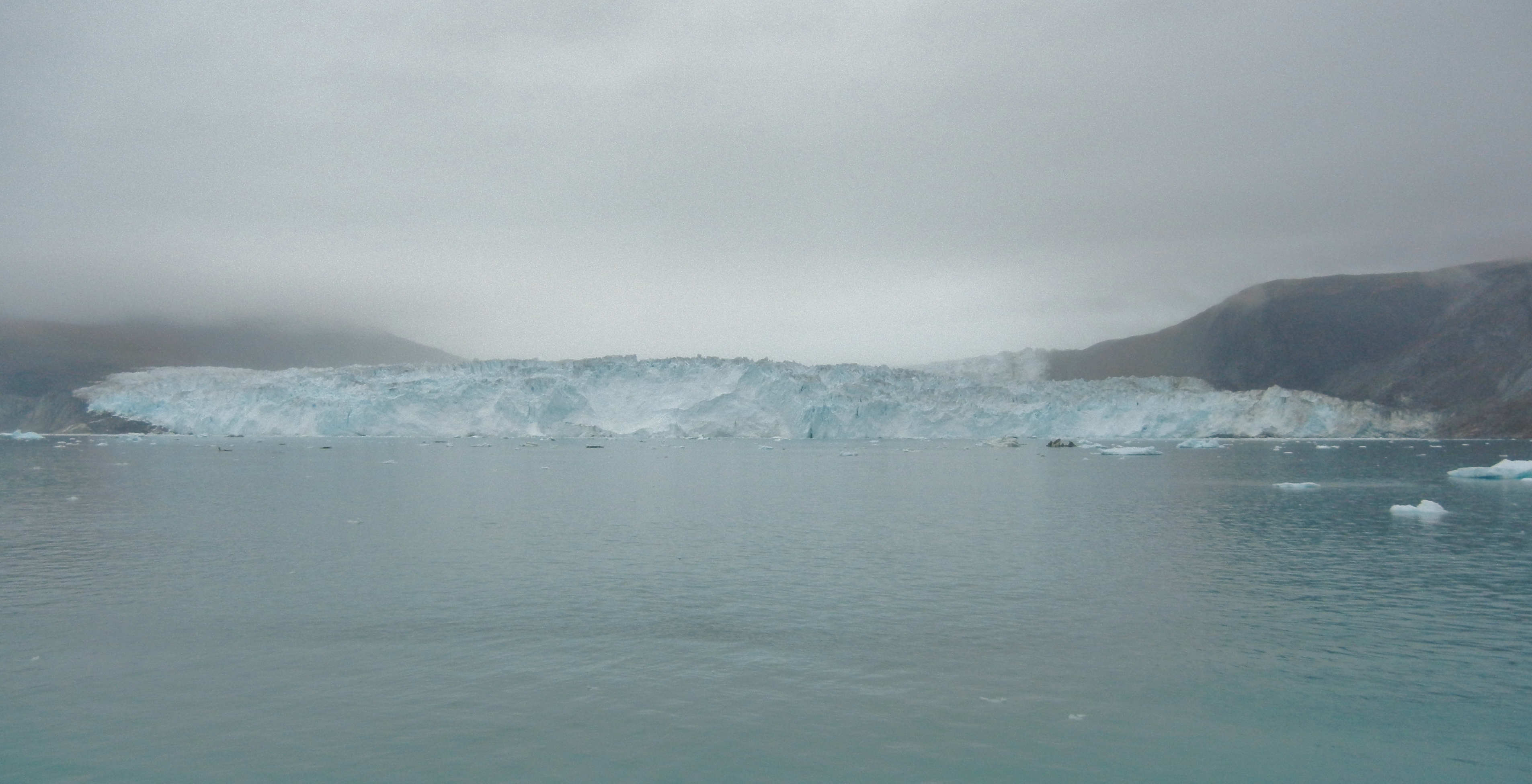
0900 Zodiac cruise at the active Eqip Sermia Glacier. This is a fast moving glacier, moving approximately 4 km per annum.
1200 Arctic style BBQ on the aft DecK
1400 Lecture in the lounge: Glaciers, Icebergs and all things icy.
1600 Special Afternoon Tea.
1700 Lecture in the lounge: Greenland, a geographical history.
1845 Daily Recap and next day Briefing.
1930 Dinner is served in the dinning room.
TV Documentaries or a film. Maybe visit to the Bridge or take a chilly stroll on deck to fill in the rest of the day. (the bridge is open 24 hours)
Day 5:
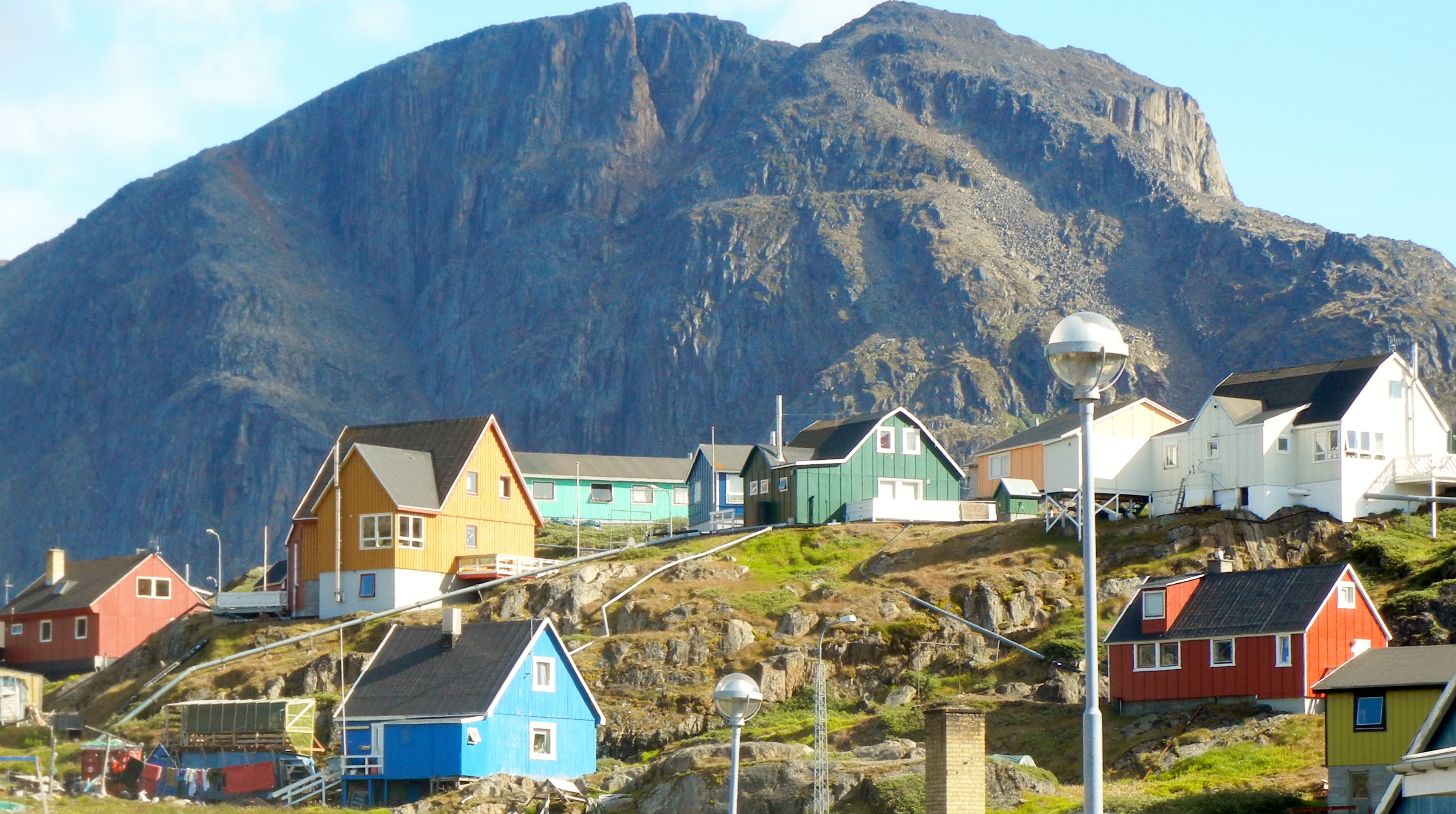
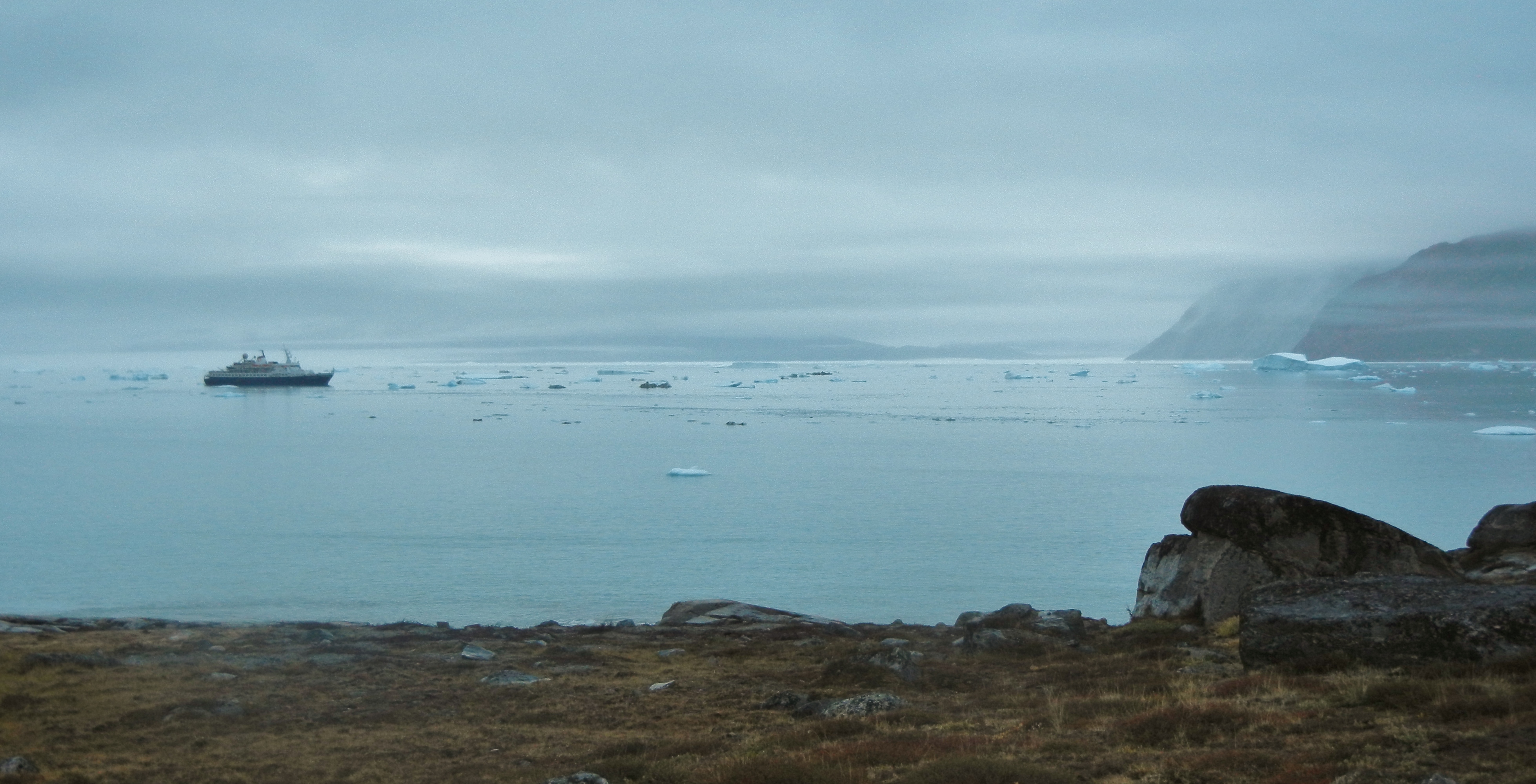
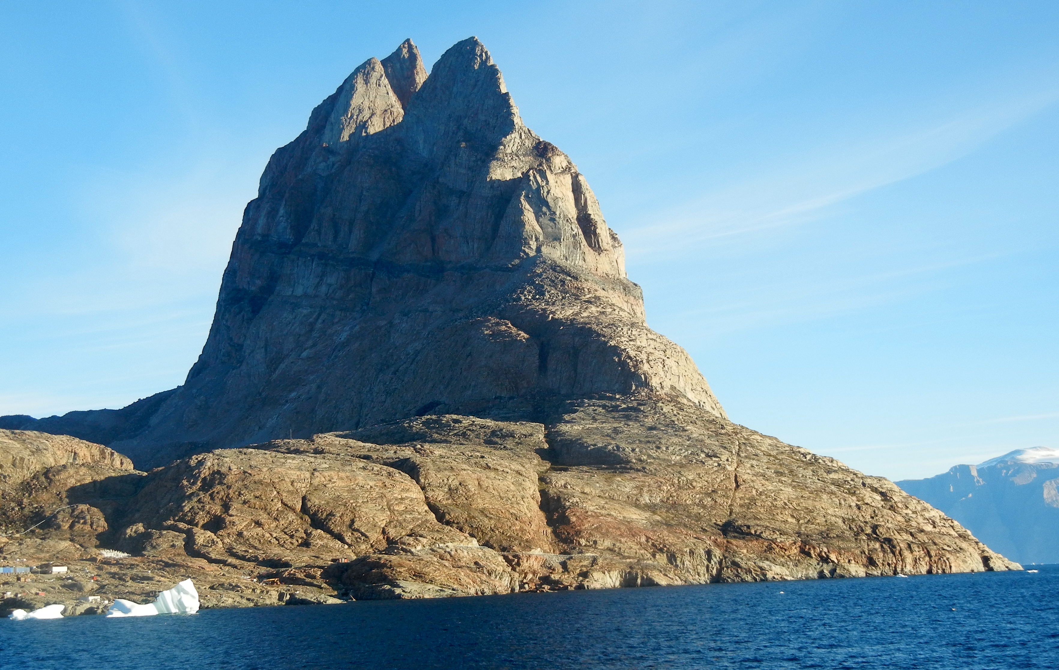
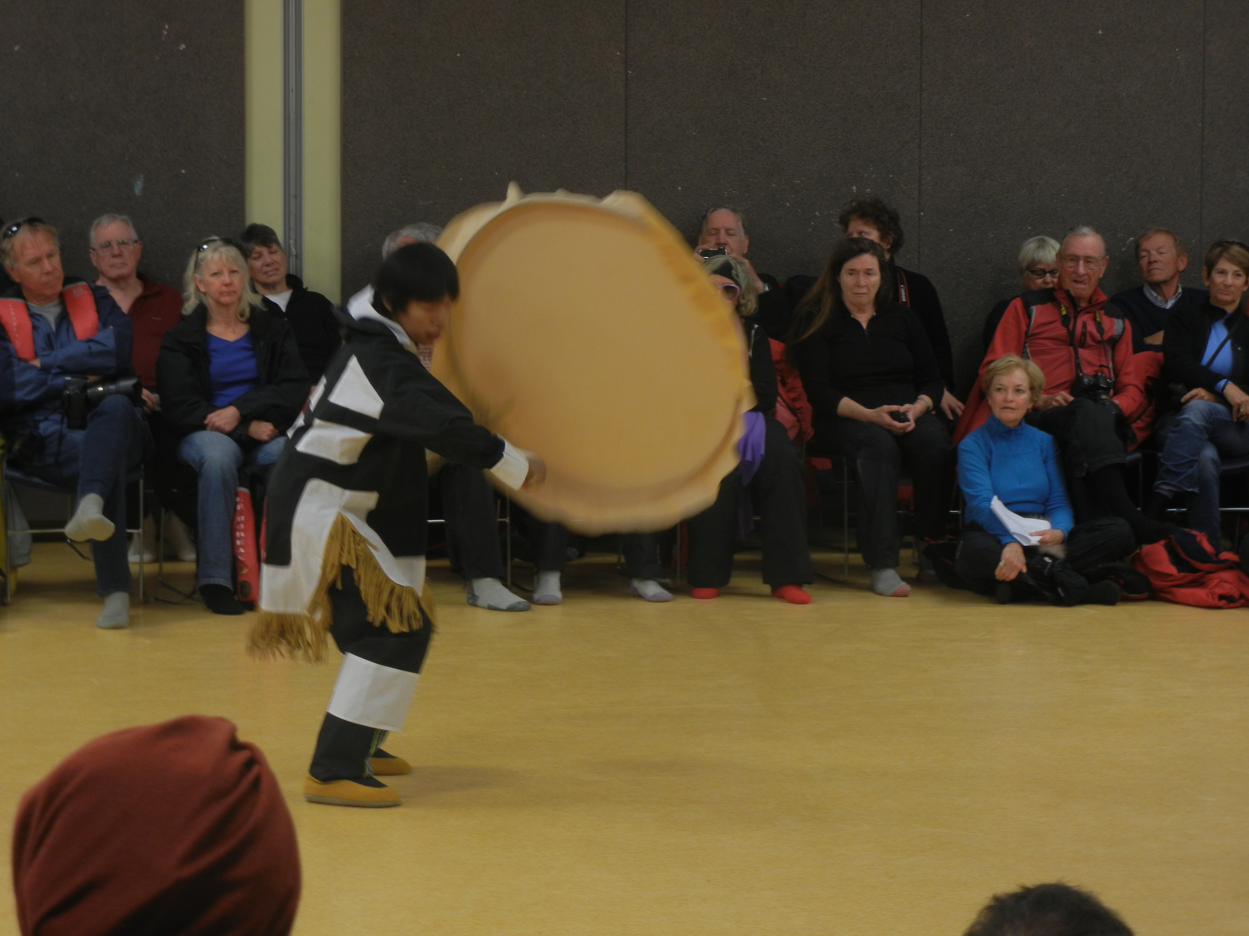
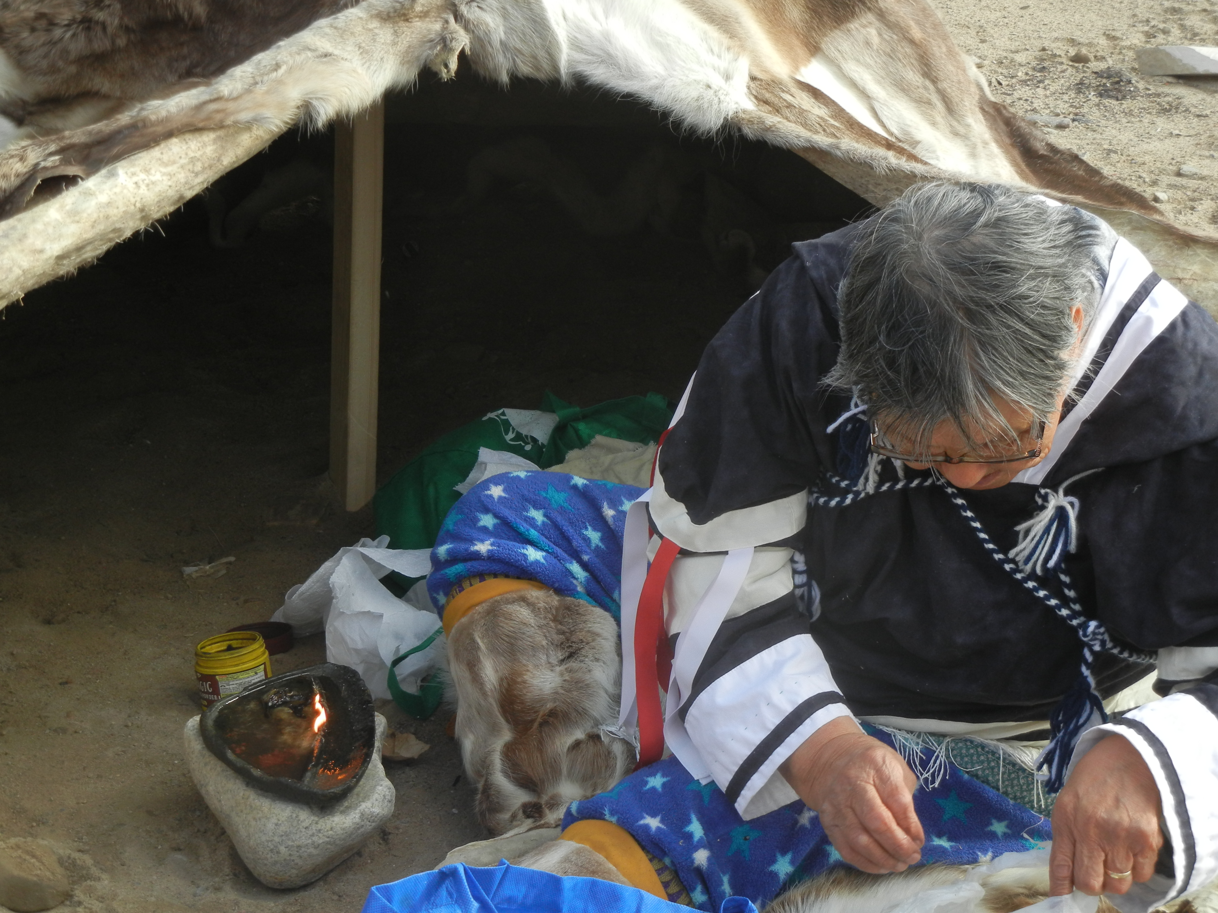
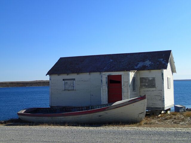
Visit the village of Uummannag, population 1200, on the island of Uummannag. Picturesquely situated under the shadow of Uummannag Mountain which rises to 1170m. The town was founded in 1763 and was originally called Omenak. It is a hunting and fishing town with its own cannery. We had a very pleasant walking tour guided by an Inuit guide. There was also a cultural event which was well attended.
Tomorrow we begin the two day crossing to the Pond Inlet which is beginning of the NW Passage. But not before sailing through some amazing Ice.
The Crossing:
A two day sail across Baffin Bay, a little rough early but settled to an easy sail. The usual lectures continued, but mainly a time to take a break, at least for Frances and myself. We have been travelling now for five weeks and need a day off.
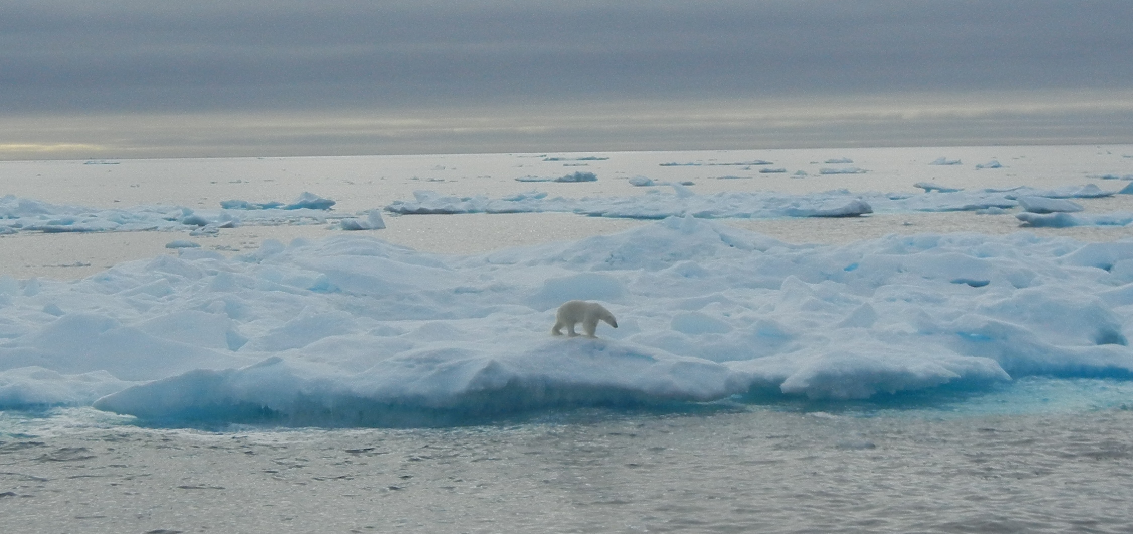
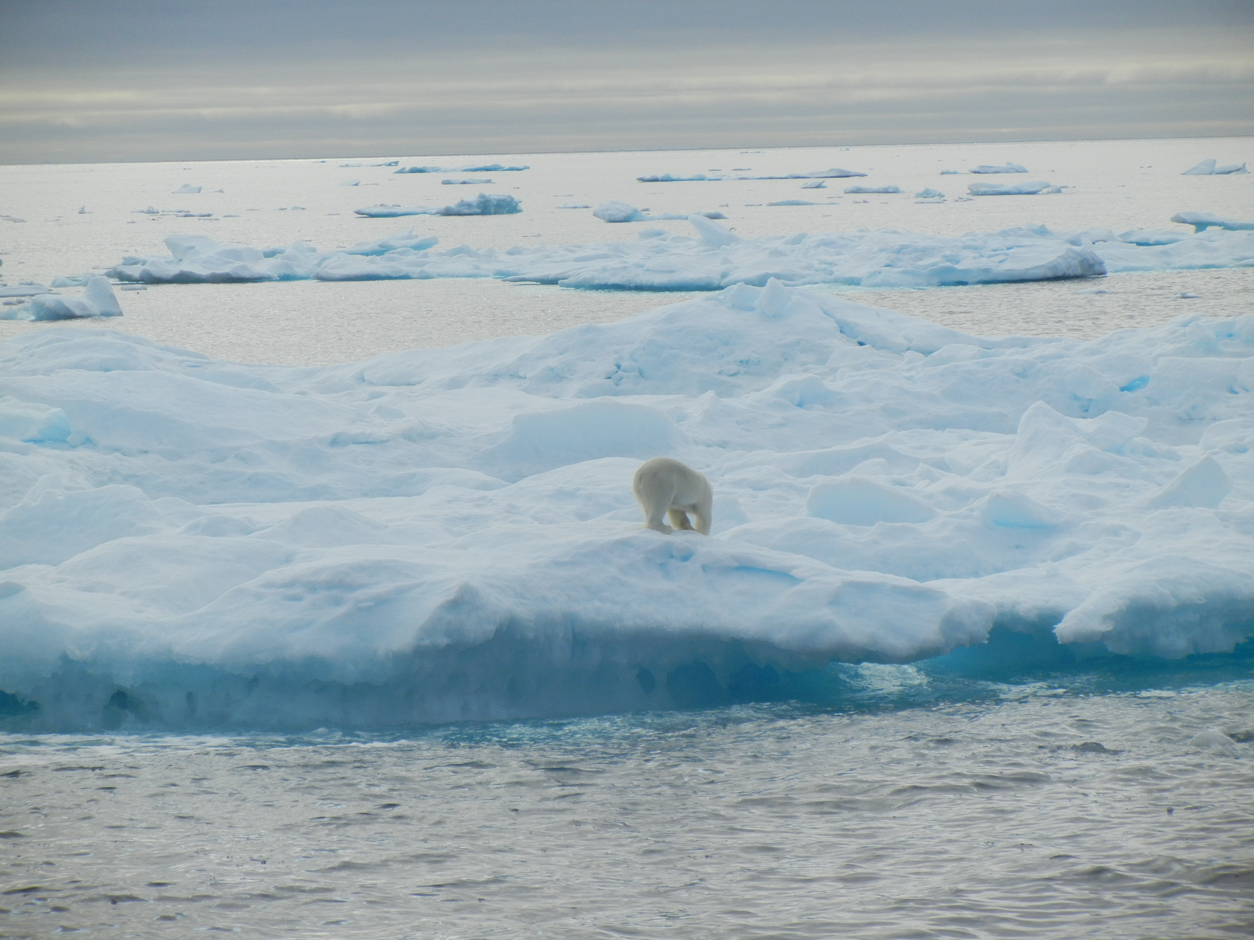
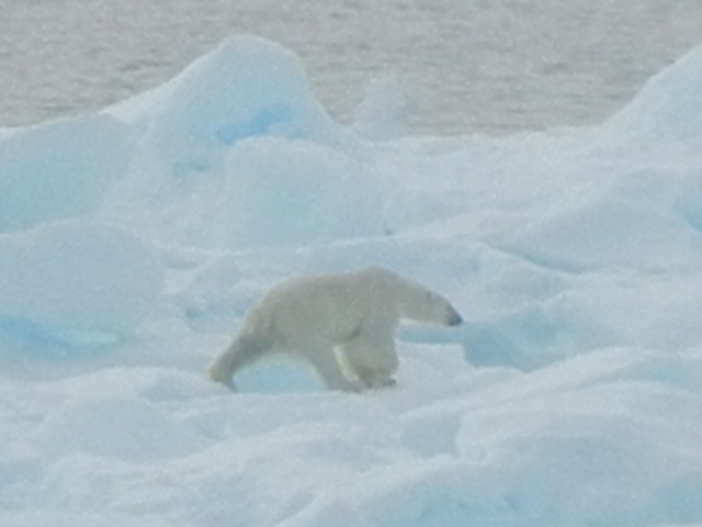
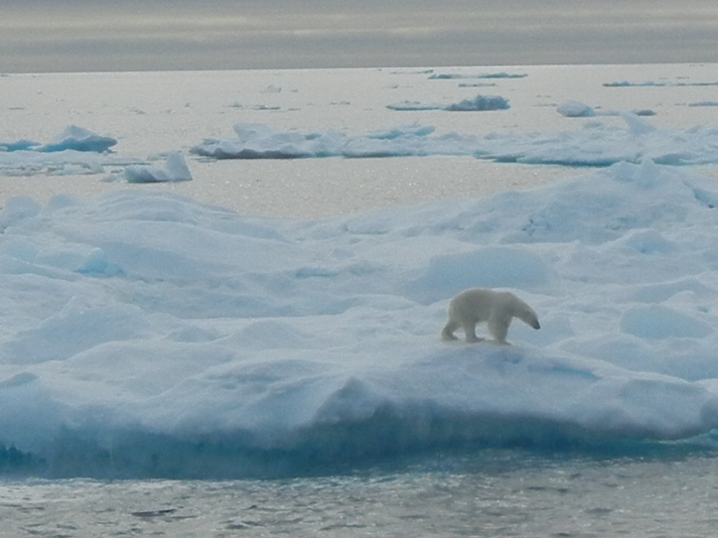
About half way across the ship suddenly powers right off and an announcement from the bridge wakes us from our afternoon slumber saying that there is a bear ahead on the sea ice. Everyone, not already on deck, soon join those who are. Excitement mounts as we slowly approach the ice flow. The Captain stops the engines so we don’t disturb our Polar Bear. We hang around for an hour and watch as he wanders around oblivious to our presence.
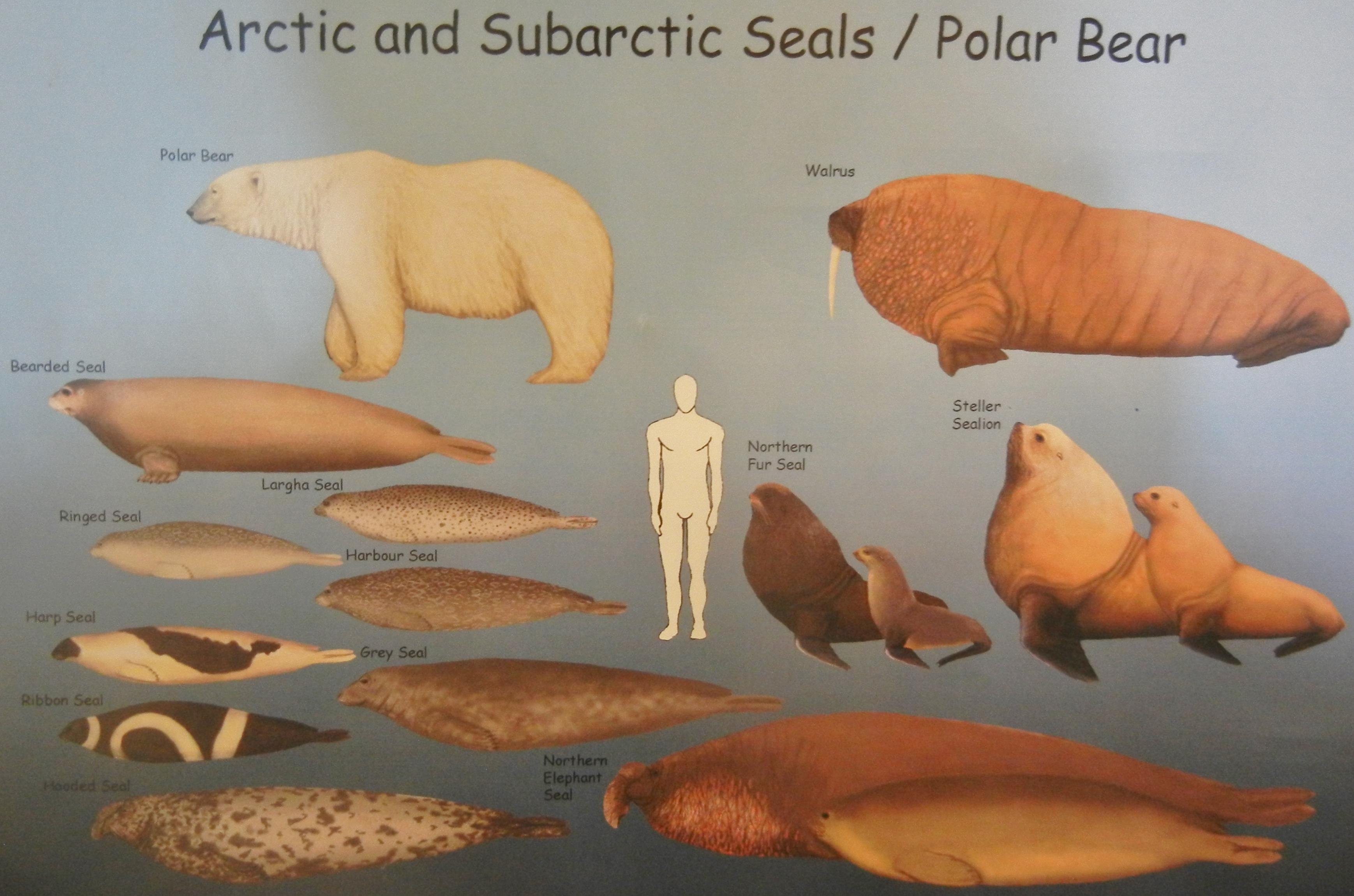
He is 100nm from land and waiting for a seal to appear on the ice for lunch. The Polar Bear is classed as a marine mammal. They are at home living on sea ice catching seals.
Pond Inlet, Nunavut Canada
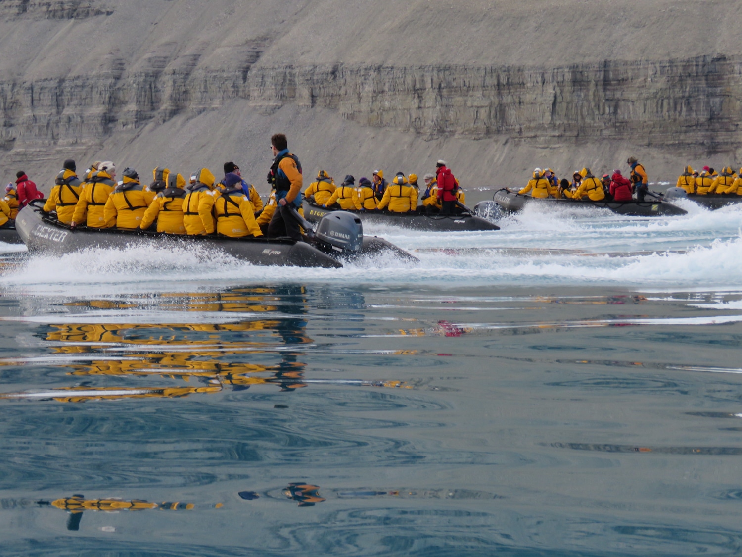
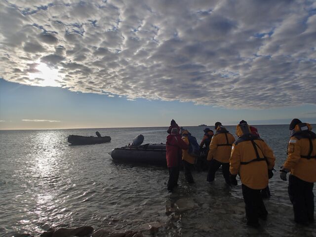
Customs come aboard to stamp our passports and formalise our entry into Canada. Then its into the Zodiacs to go ashore and a beach landing. Gumboots (supplied) required for a wet landing.
A presentation by Parks Canada, Cultural event, walk the town, check the supermarket, always interesting, treated with hot tea, bannok, muktuk and some other country foods. All good.
Nunavat is the largest, northernmost, newest and least populous territory of Canada consisting of northern canada and many large islands. It is the same size as Western Australia, has a population of 32,000, mostly Inuit. The area includes the Northwest Passage
Now the history of the search for the Northwest Passage is full on with lectures and documentaries to fill our day. We are sailing as far as possible, the route taken by the ill fated ships of Sir John Franklin’s voyage.
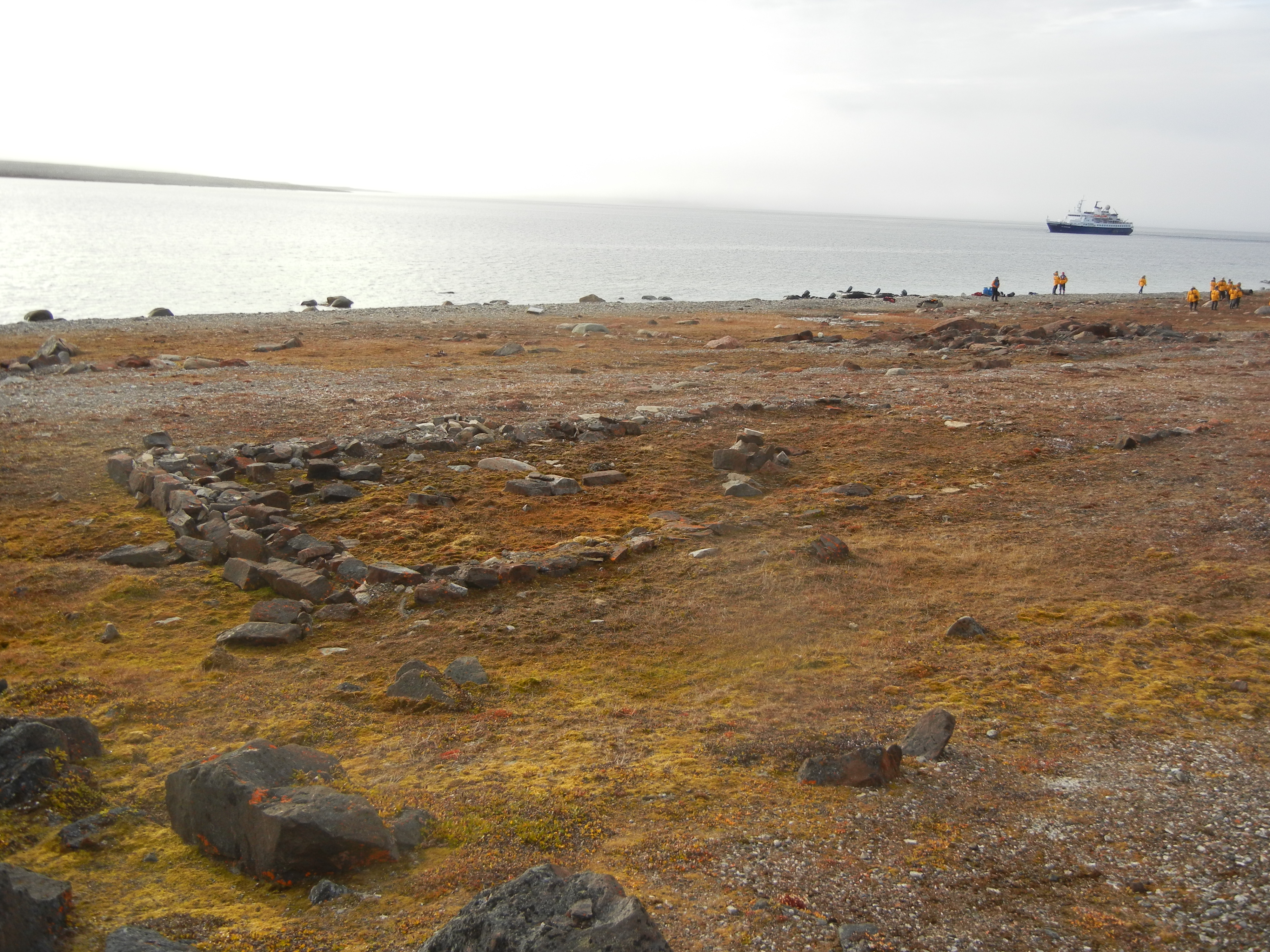
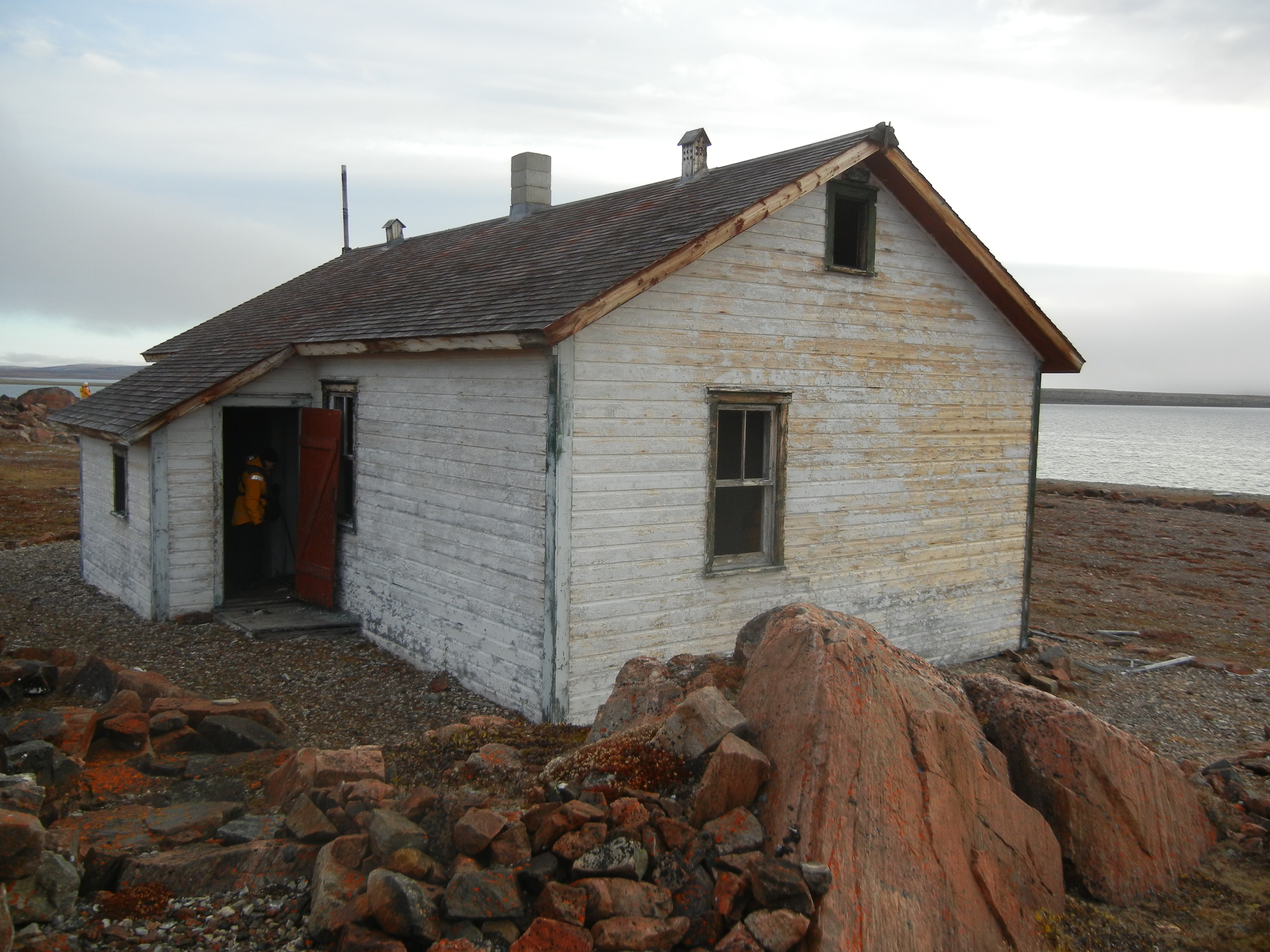
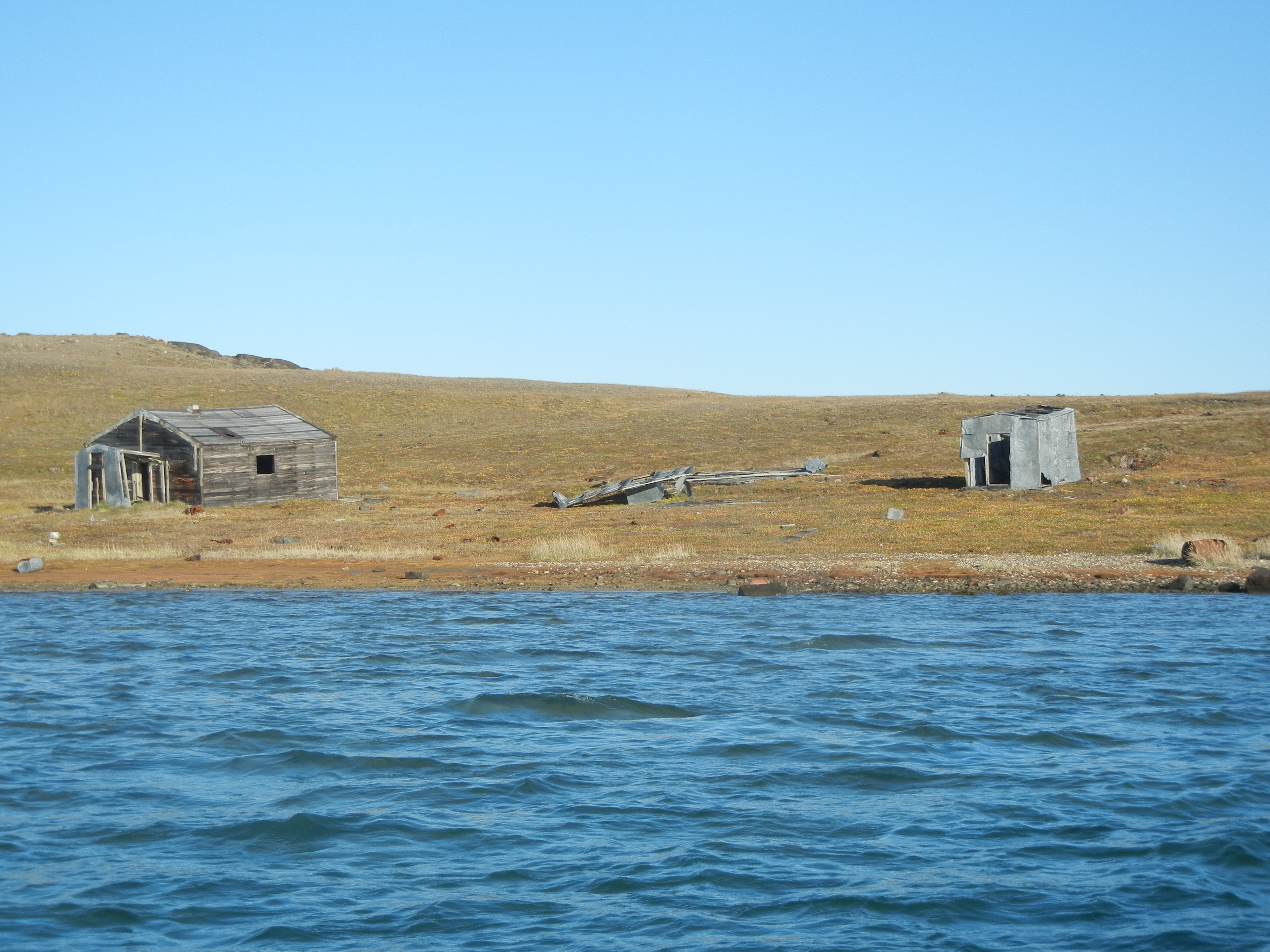
Day 8: Dundas Harbour.
Dundas Harbour is a former Royal Canadian Mounted Police outpost. We explore what remains of police buildings, accommodation, workshops, stores and dog compounds. The buildings are in poor condition. there are two graves. one of a policeman who died accidentally and another who committed suicide. What a lonely life in desolation this would have been.
We moved round the corner to Croker Bay where a musk ox was sited along with a polar bear.
Day 9:
Anchored in Ryder Inlet, Maxwell Bay. 74deg. 46.6′ N 088deg.
We are now about 500 nautical miles (910 km.) north of the arctic circle.
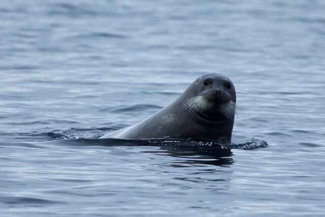
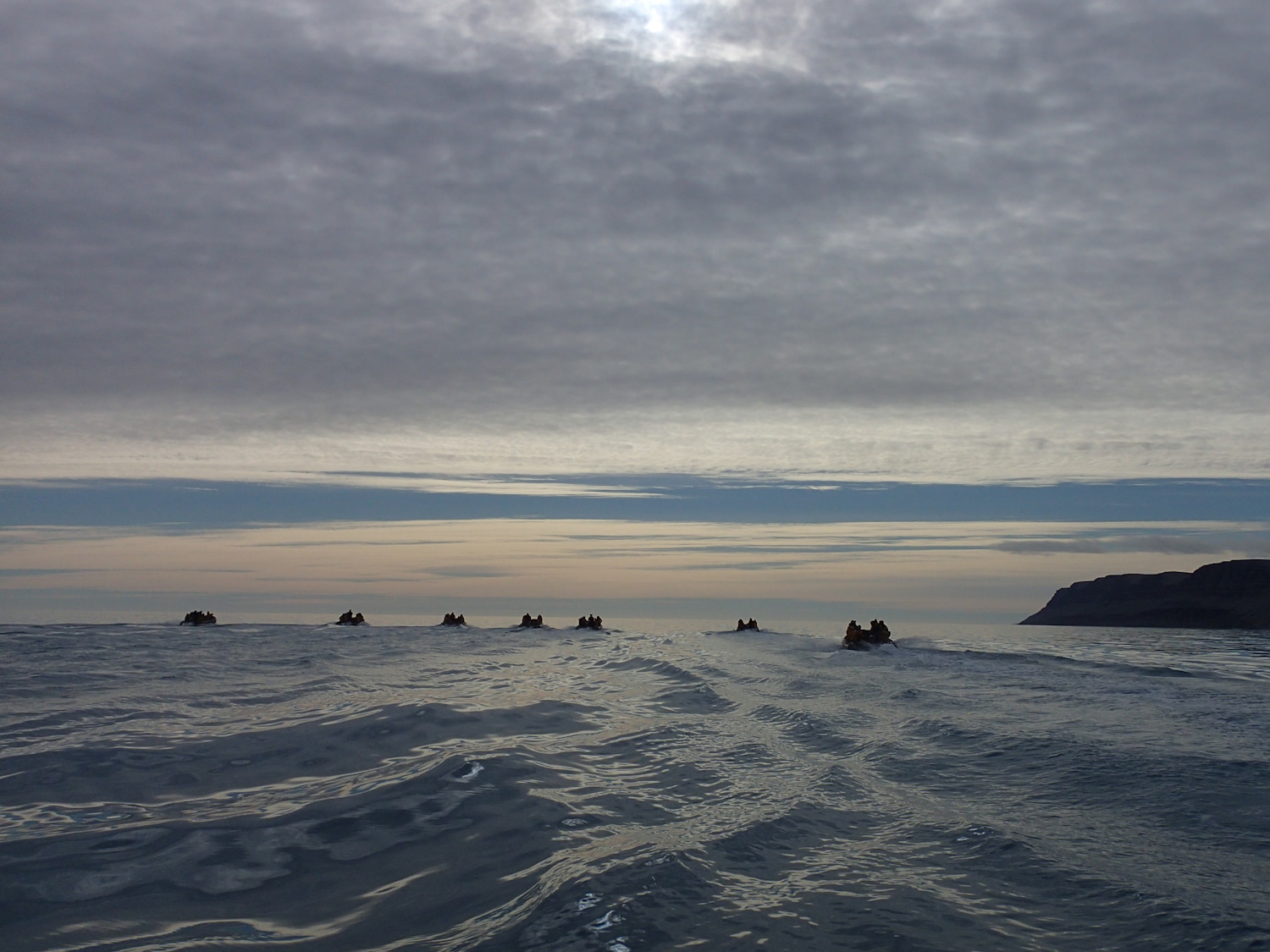
We set off at 9:00am in the Zodiacs to search for walrus. Only one was sighted (not by me), a young one in the water. However a number of seals, including a bearded seal, a pomarine jaeger, falcon, guillemots, snow geese, glaucous gulls, and a mother and cub polar bear.
Day 10: Radstock Bay
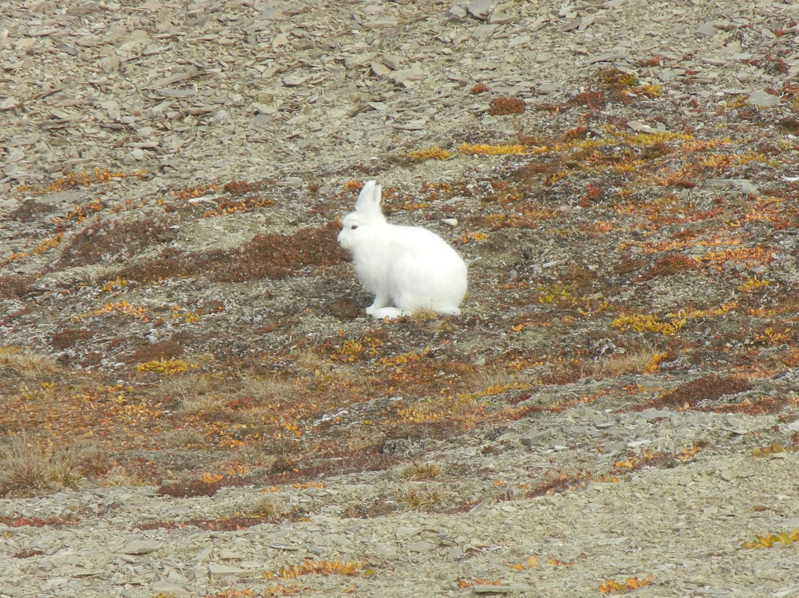
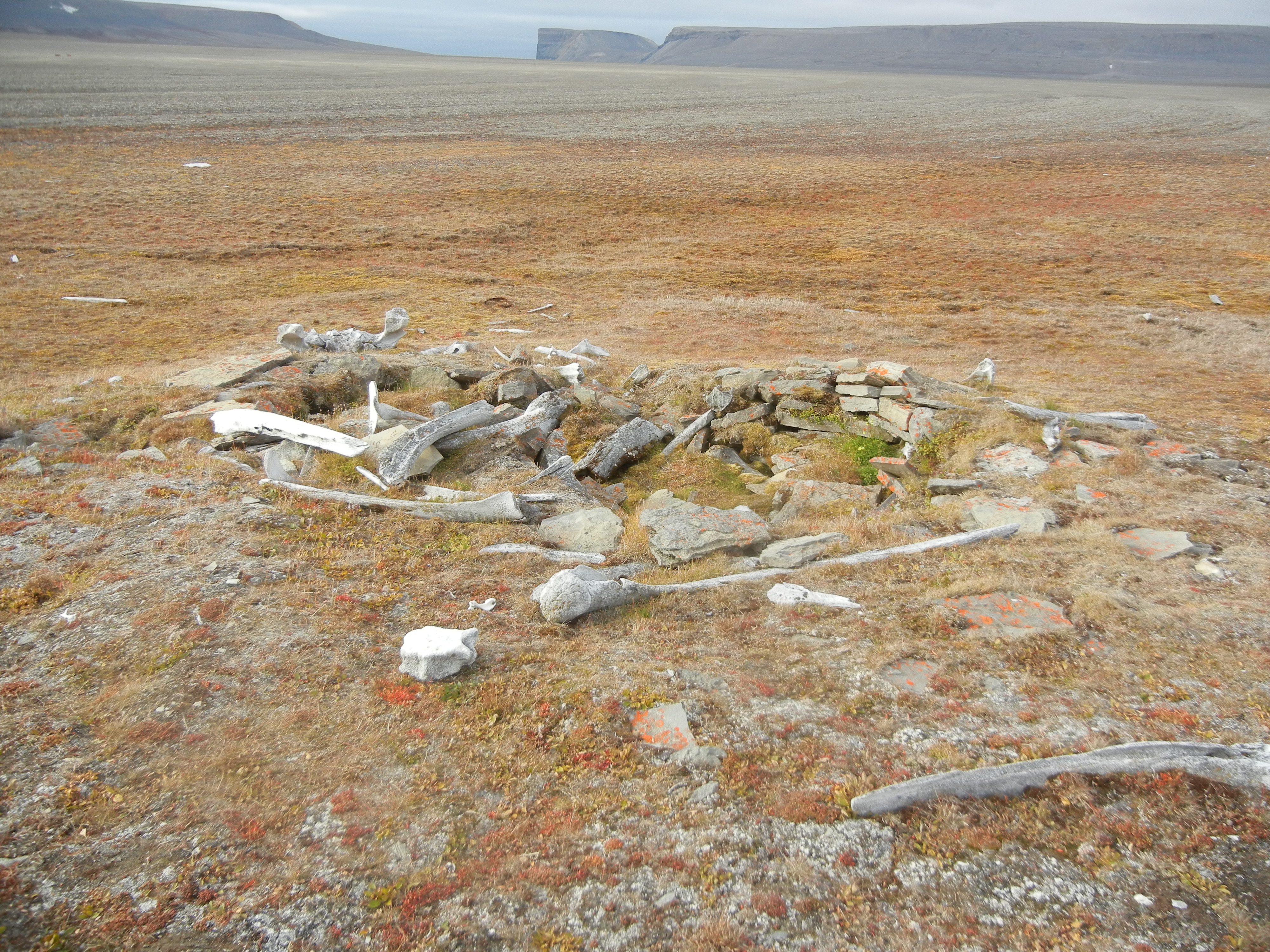
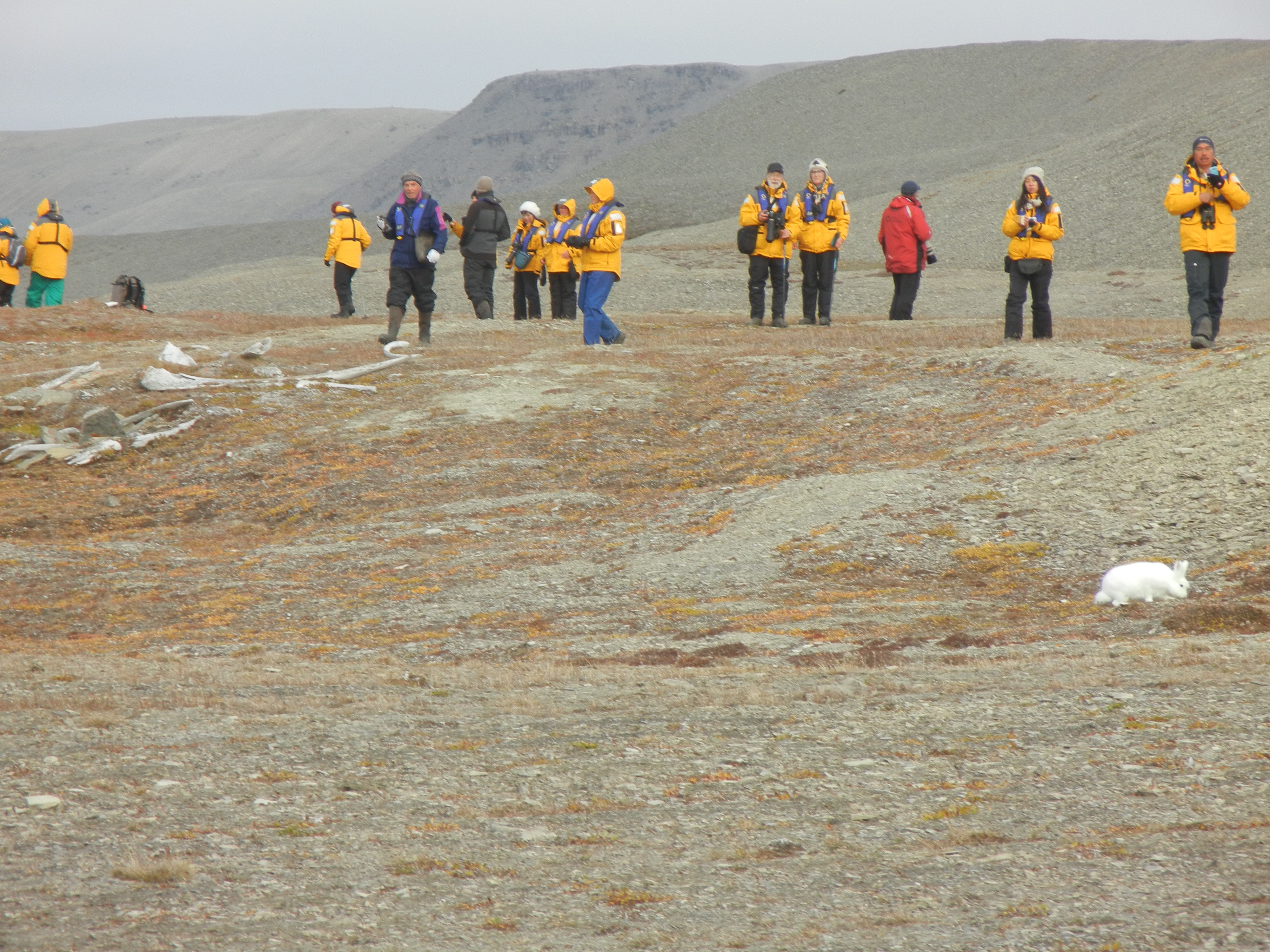
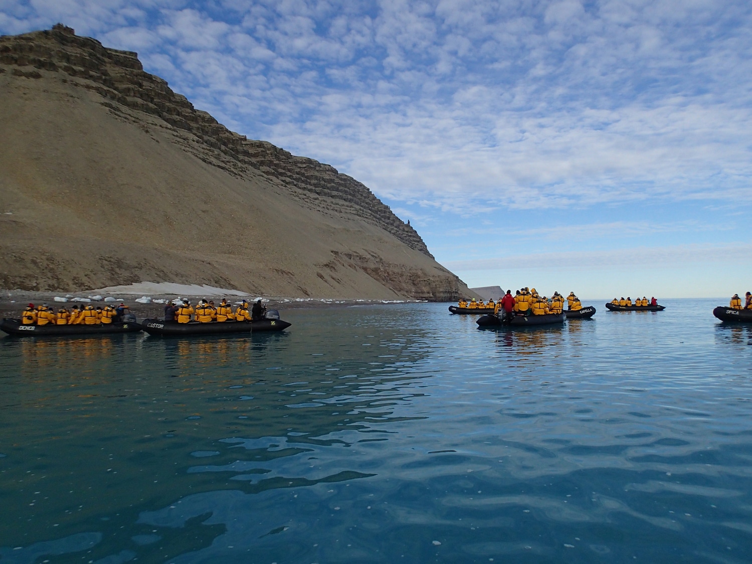
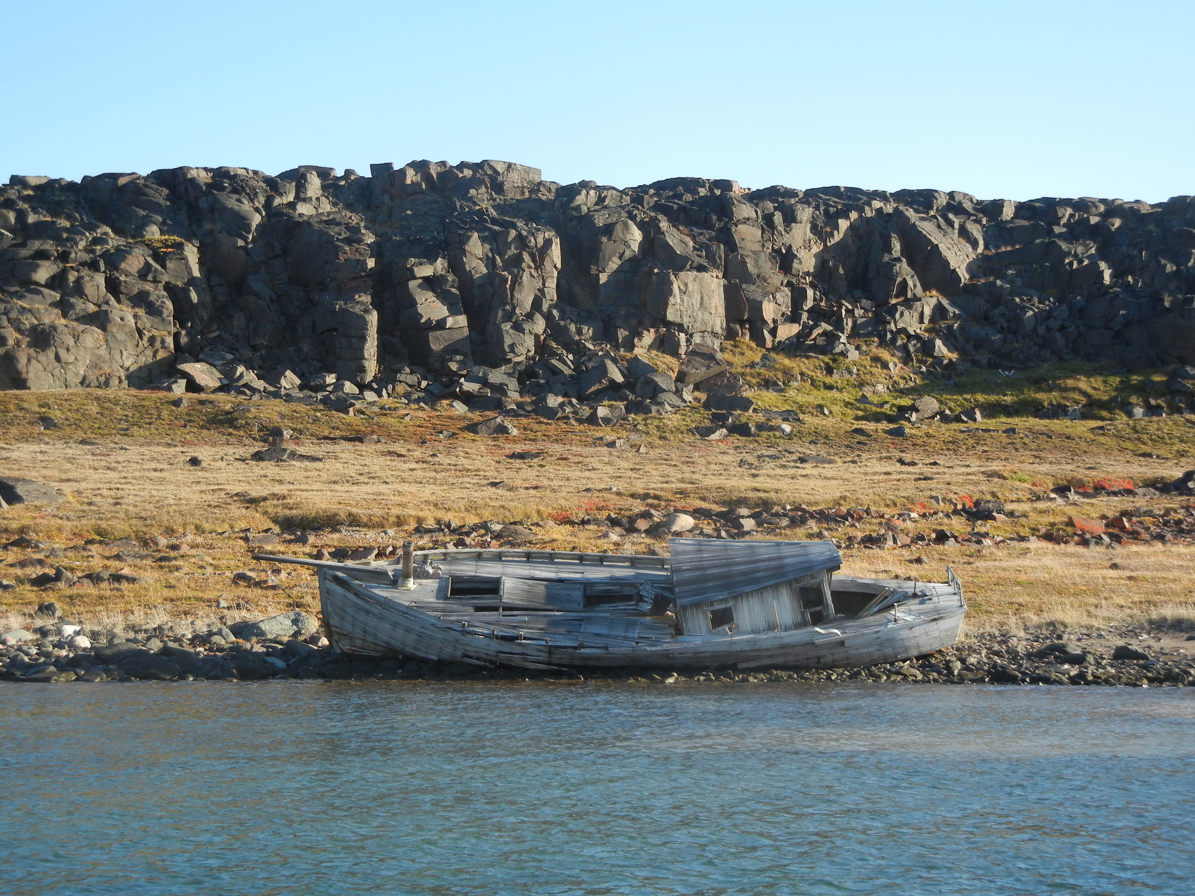
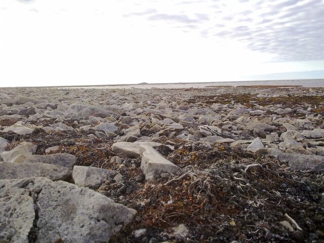
A 6:30 start for a couple of the Expedition Staff who left in a zodiac to scout for Walrus but alas none were found in the area so Sea Adventurer continued onto Devon Island. A swell was running both at the ship and on shore so disciplined embarkation and disembarkation was called for. All safely ashore we found remains of meat caches and tent rings of the Inuit people. We were also entertained by an Arctic Hare who hopped around amongst us while continuing to feed, mainly on moss.
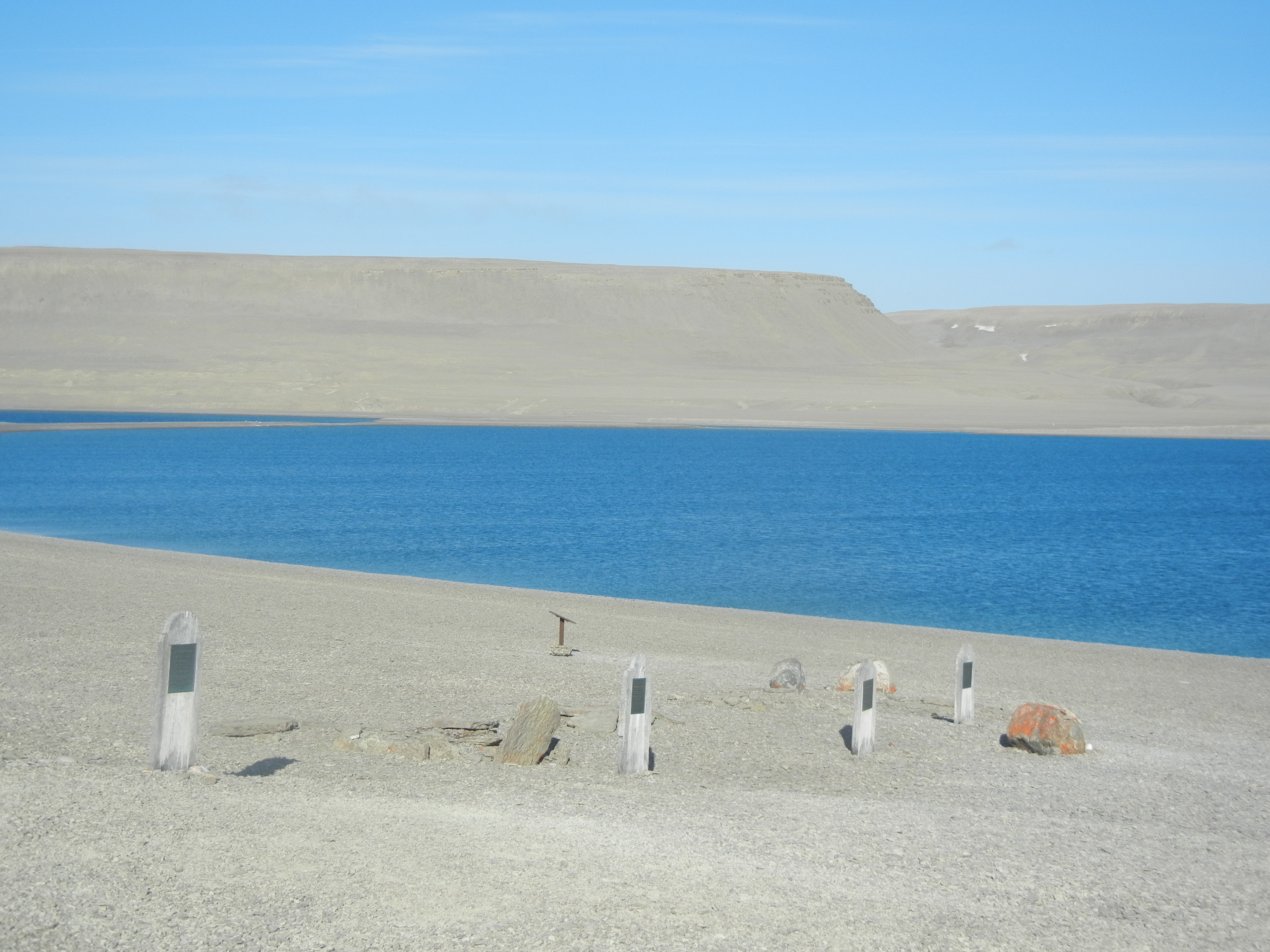
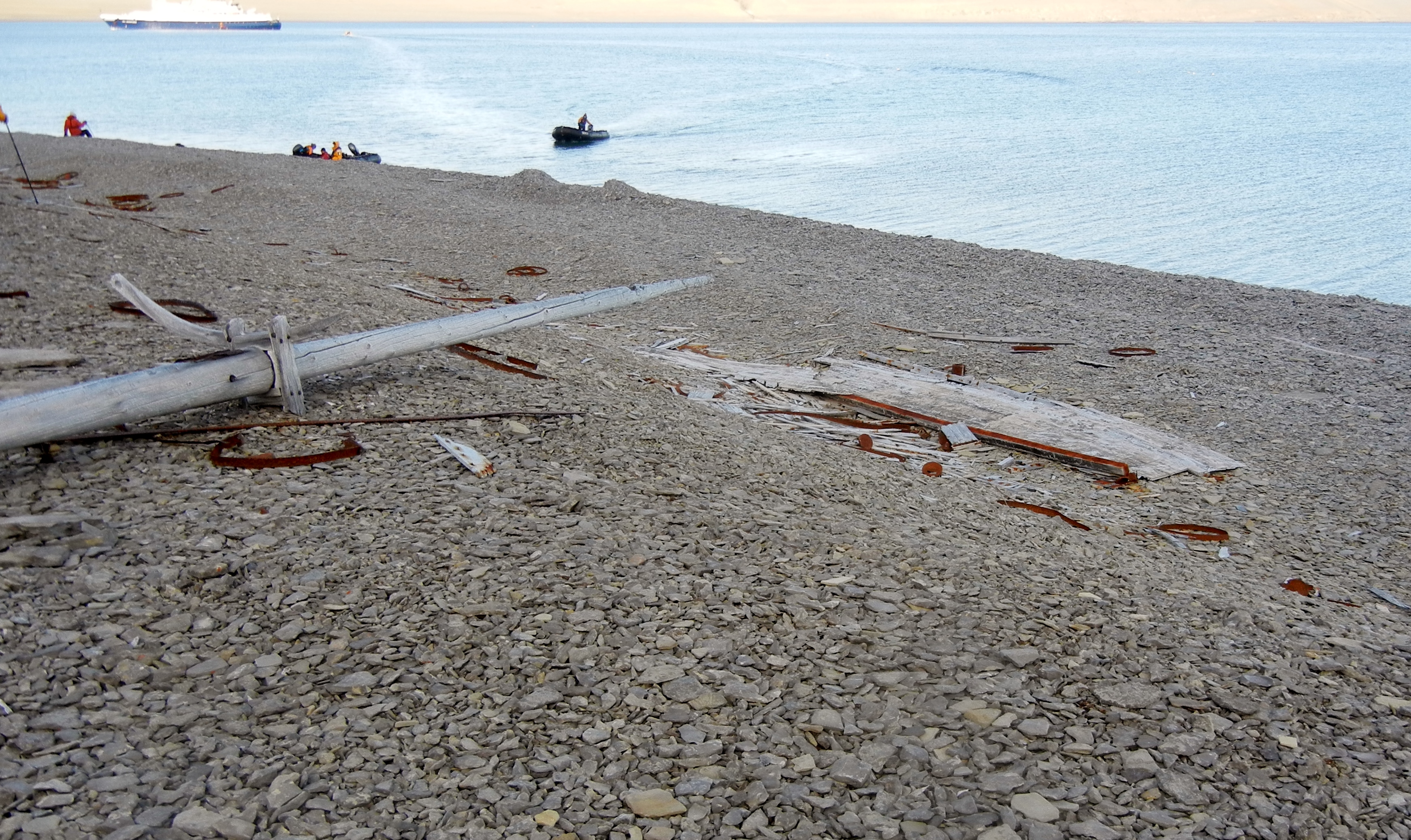
All safely on board for lunch and sail to Beechey Island. On shore we find the graves of three of Franklin sailors, one from Investigator and Bellot’s memorial grave. Once finished at this location, we were shuttled by Zodiac to the site of Franklin’s first winter camp, and the remains of Northumberland House, left here with supplies in 1854 by North Star, part of Belcher’s search expedition.
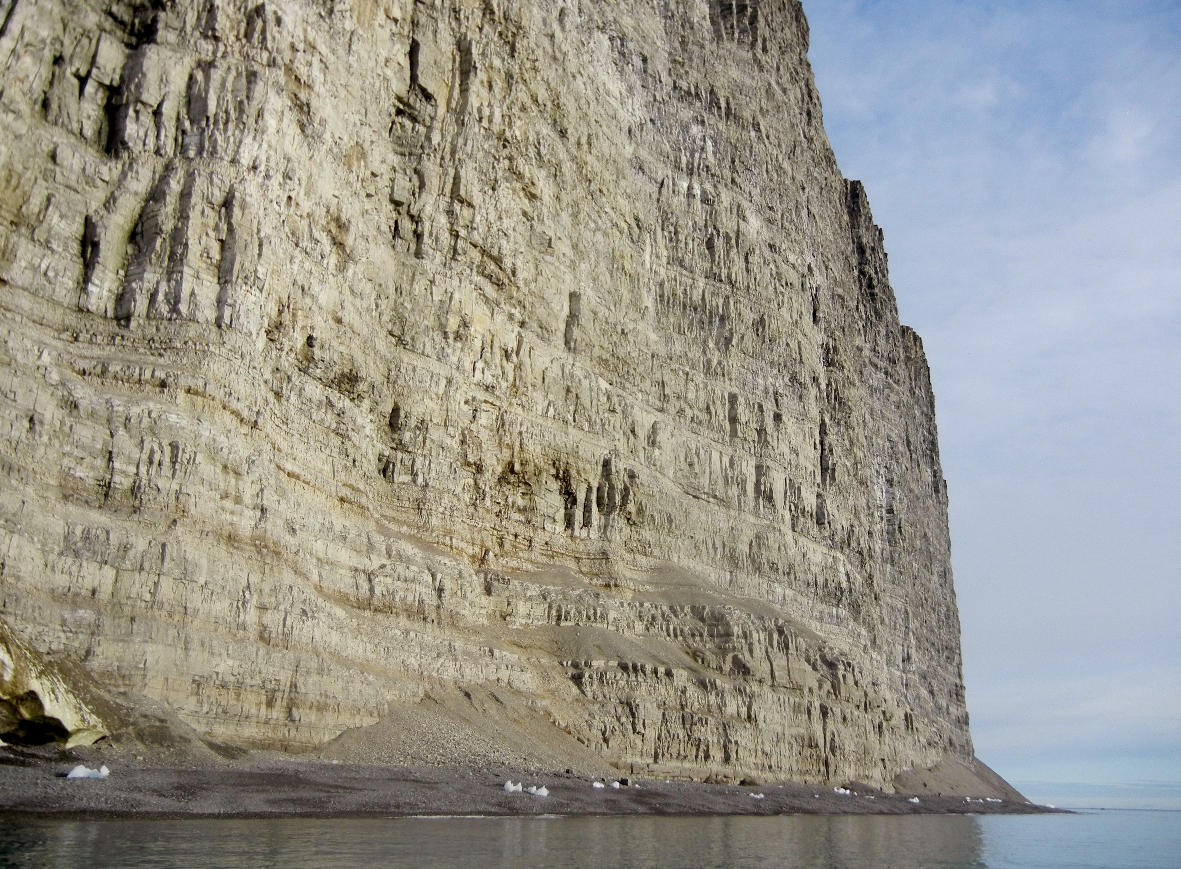
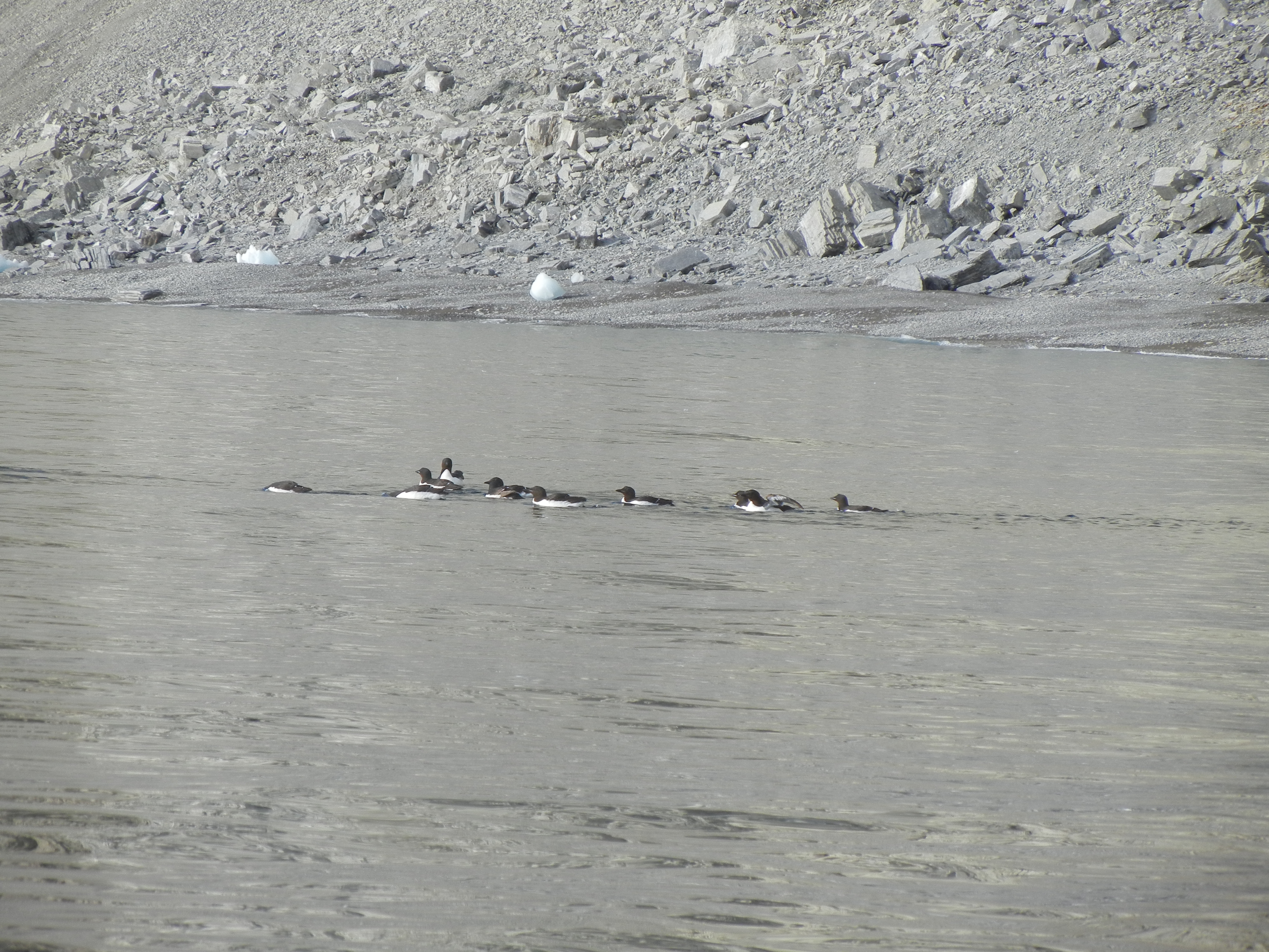
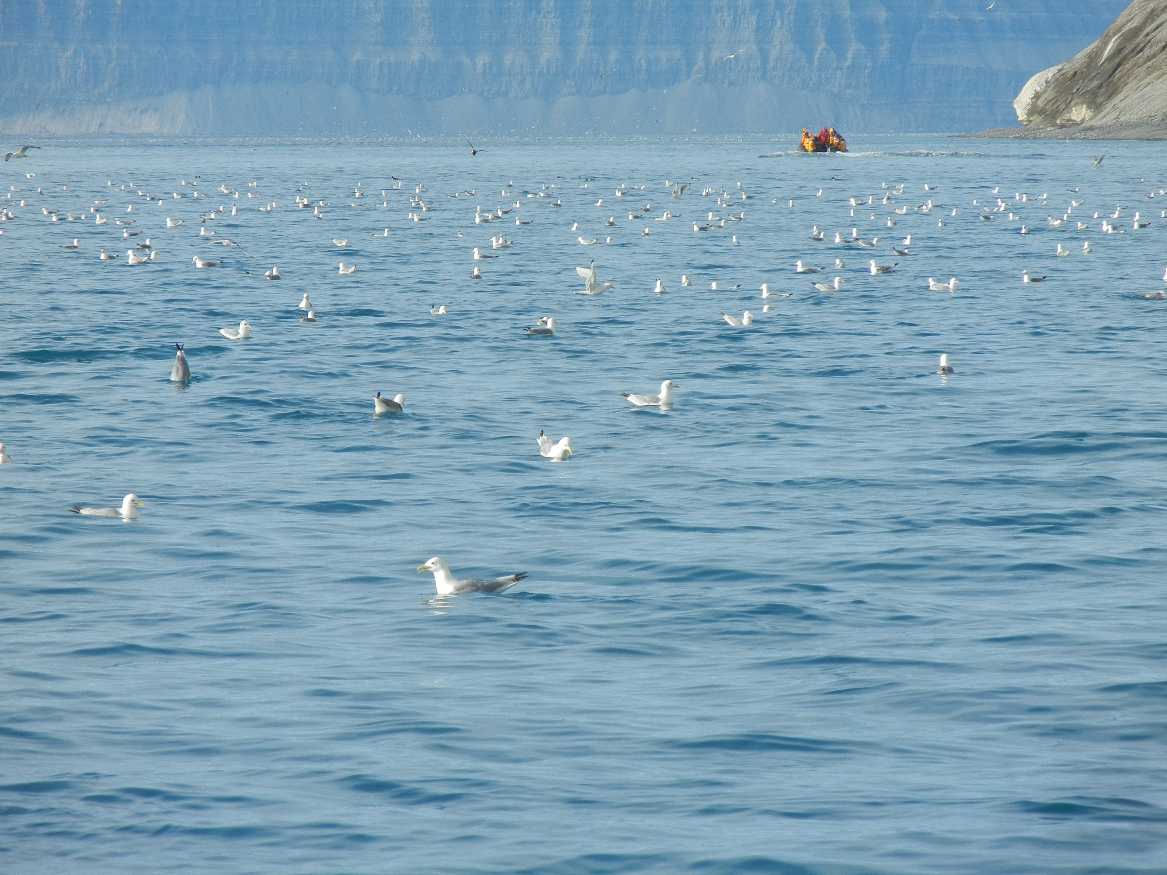
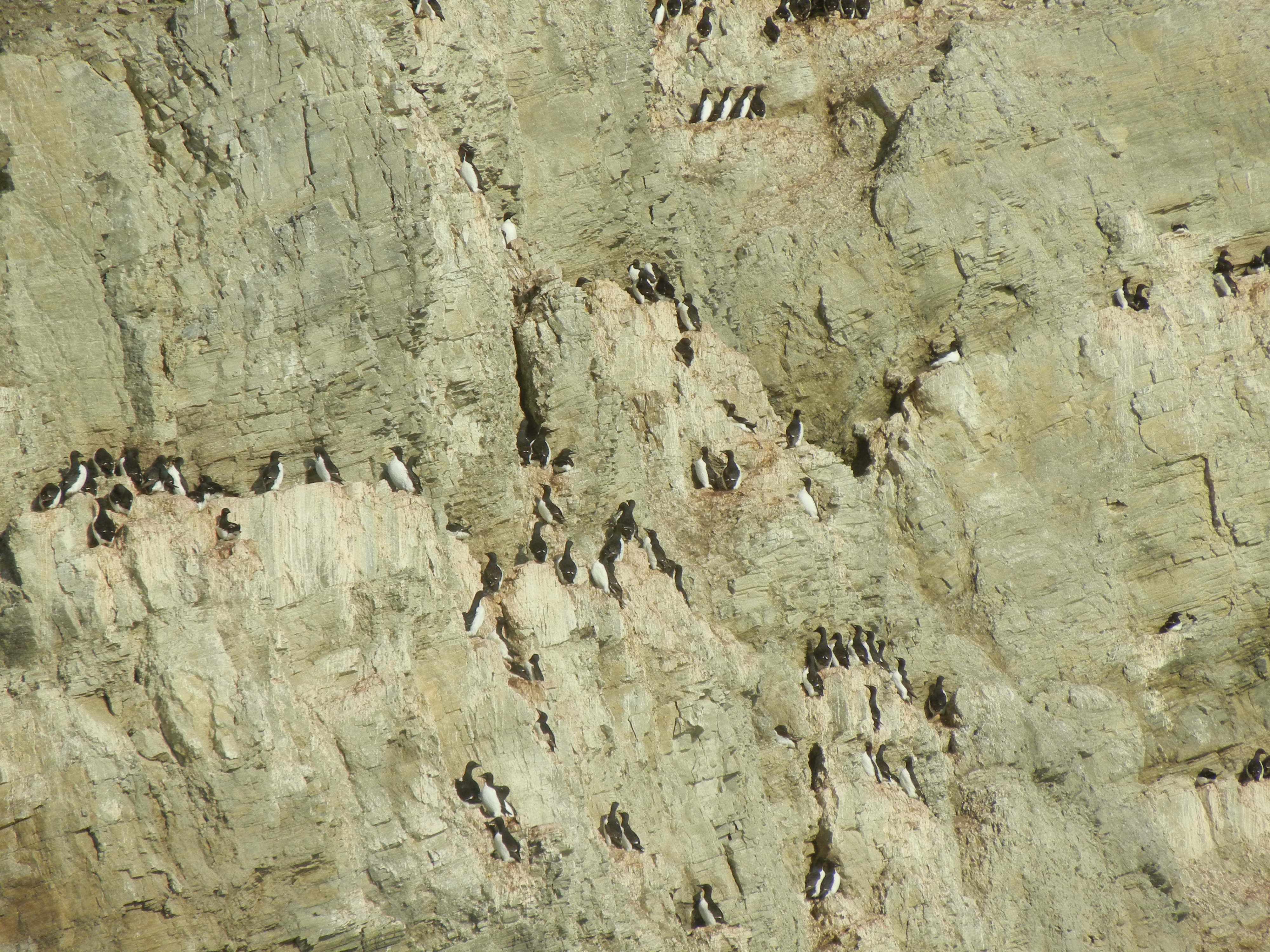
Day 11: Leopold Island Cliffs
These cliffs, 120 meters tall rising up from the sea are loaded with nesting birds, some of which have already left their roost. The Birdo’s logged: the very active black guillemots, northern fulmars, and glaucous gulls.
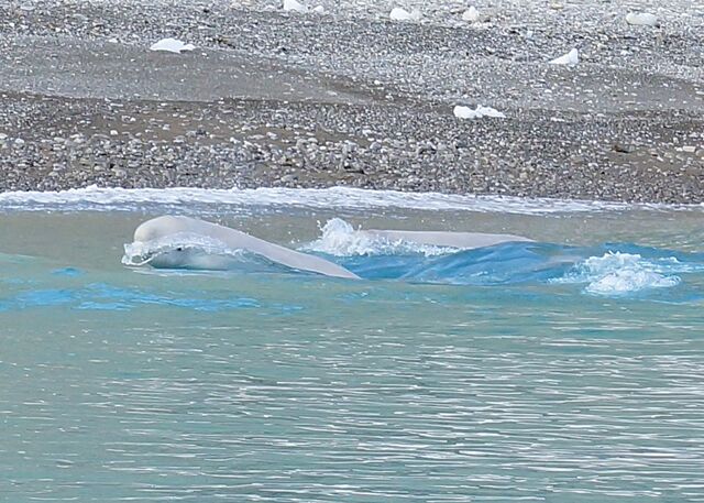
Later in the day we sail into Port Leopold observing, first a mother bear and two cubs, followed by a large pod of Beluga whales. The bears disappear over a hill, so we took to the zodiacs to head off the belugas as they headed out of the bay along the coast. Ten Zodiacs full speed down the bay was a sight on its own.
We picked a suitable posi about 30 or 40 meters off the shore and we waited and we waited. They were taking their time.
Here they come 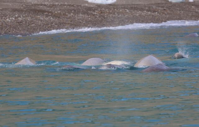
And here they are, everywhere, even under the Zodiacs.
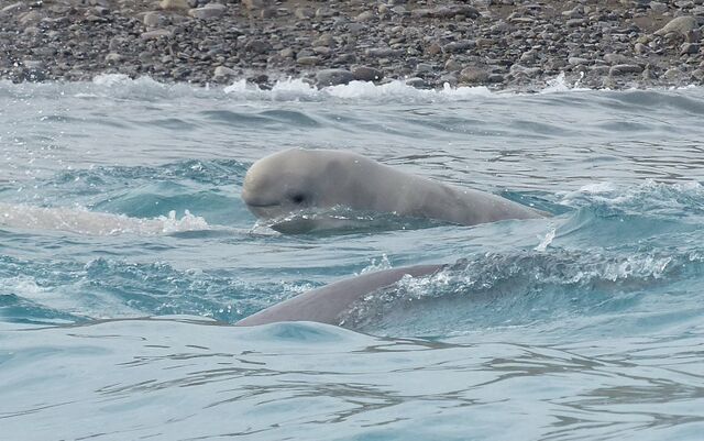
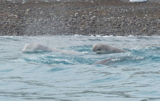
And then they were gone!
Day 12: Fort Ross – Bellot Strait – Prince of Wales Is.
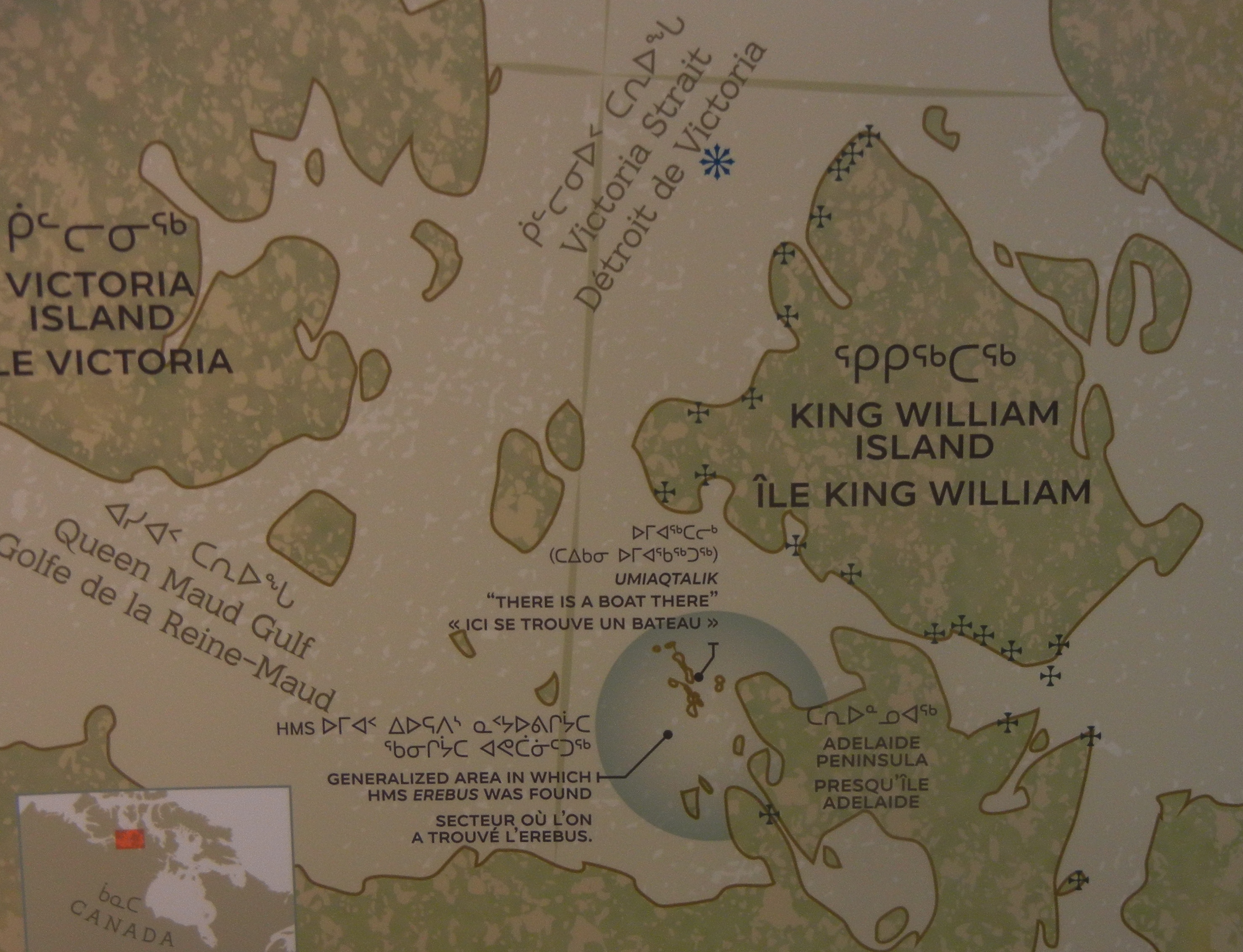
These sites are dripping with history. Kennedy and Bellot were here in 1852 while on a search expedition, funded by Jane Franklin, looking for evidence of Sir John Franklin’s two lost ships, the Erebus and Terror, and crew of 130 men, from his expedition in 1845.
Copy from a previous post. Posted 23/12/2014
A brief history
The first recorded attempt to discover the Northwest Passage was the east-west voyage of John Cabot in 1497, sent by Henry VII in search of a direct route to the Orient. There were a dozen other expeditions that followed during the 16th and 17th century. More expeditions in the 18th century, including one by Captain James Cook in 1788, failed to find a passage. In the 19th century many expeditions, including one by Sir John Franklin, on land and sea, found and charted some areas for a possible passage.
In 1845 a lavishly equipped two-shipped expedition led by Sir John Franklin sailed the Erubus and Terror to the Canadian Arctic to chart the unknown areas of the Northwest Passage. They sailed fully confident with only 500 km of coast still to chart. The ships failed to return. Relief expeditions were sent over the next century and a half and many artifacts, records, notes and remains were found.
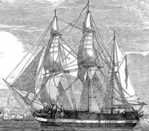 Erebus
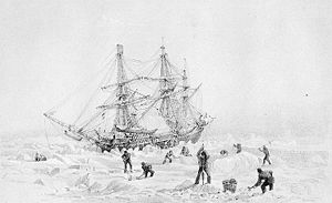 Terror
Franklin had died in 1847 and Captain Crozier had taken command. The ships became fast in ice. The decision was made to abandon ship and the men made their way south across the tundra by sledge. All were lost. Some of the crew may not have died until the early 1850’s. No evidence had been found of any survivors. Starvation, exposure and scurvy all contributed to the deaths. Later examination of three bodies exhumed from permafrost on Beechey Island revealed high concentrations of lead in all three. (the expedition carried 8,000 tins of food sealed with lead-based solder) Oh dear
Exploration continued for the remainder of the century and a route was discovered, when in 1854, Sir Edward Belcher made a transit of the Northwest Passage albeit by ship and by sledge over the ice, becoming the first people to circumnavigate the Americas.
The first explorer to conquer the passage solely by boat was the Norwegian explorer Roanld Amundsen. It was a three year journey between 1903 and 1906 in a small boat, the ‘Gjoa’ with 6 men. He figured he would have to live off the land and a small crew would be easier to feed.
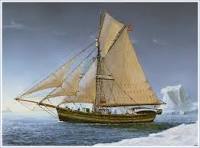
He spent almost two years stuck in ice at King William Island before breaking through the passage. Although he had achieved a traversing of the passage, the route was not suitable for commercial use, because many of the waterways were only 3 feet deep.
Canadian Henry Larson was the second person to sail the passage, leaving Vancouver 23 June 1940 and arriving Halifax on 11 October 1942. (28 months) He made the return trip from Halifax to Vancouver in 1944 in a greatly reduced time of 86 days. This made him the first to traverse the passage in one season. He used a more northerly, and partly uncharted route for his second crossing.
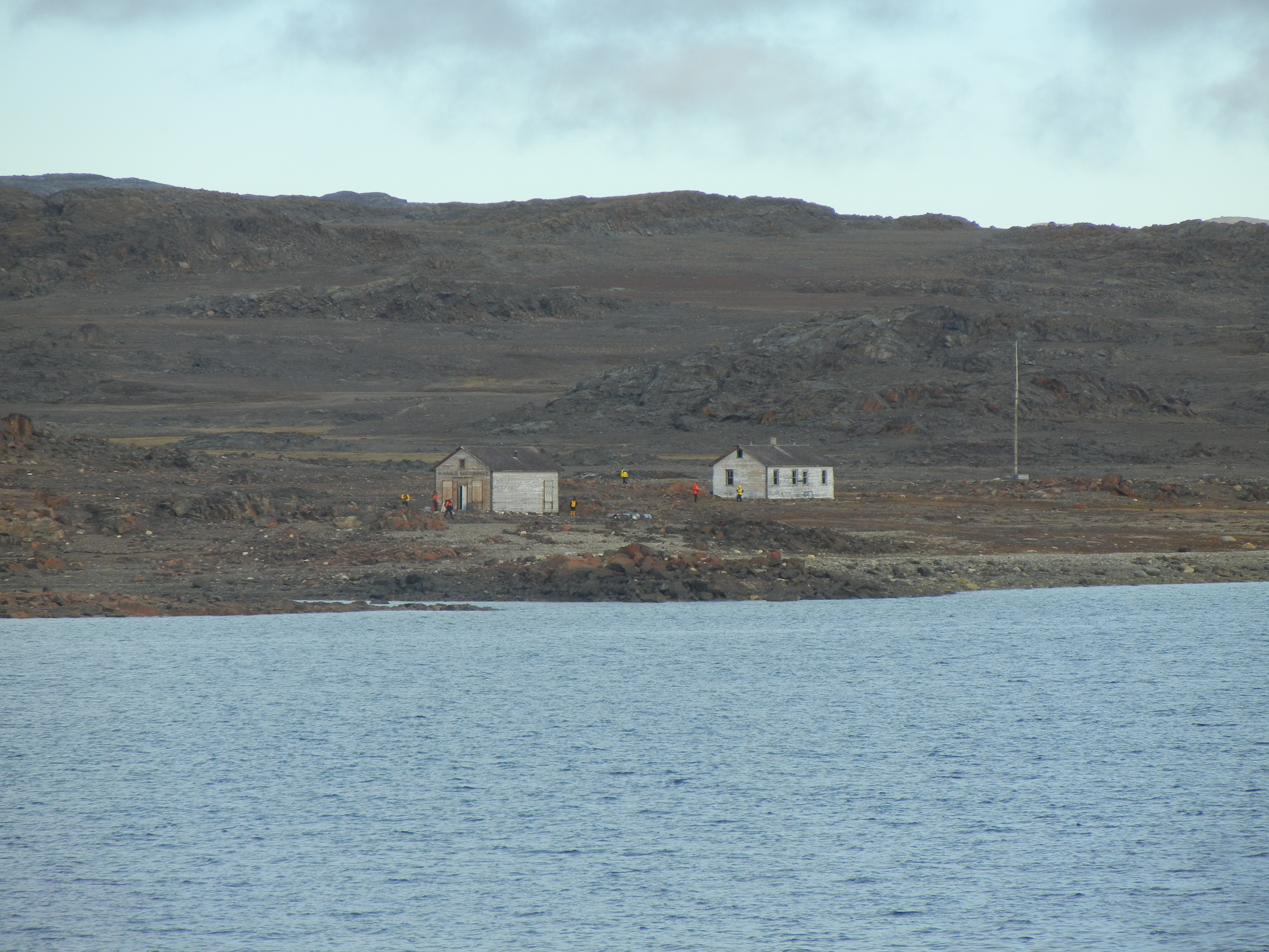
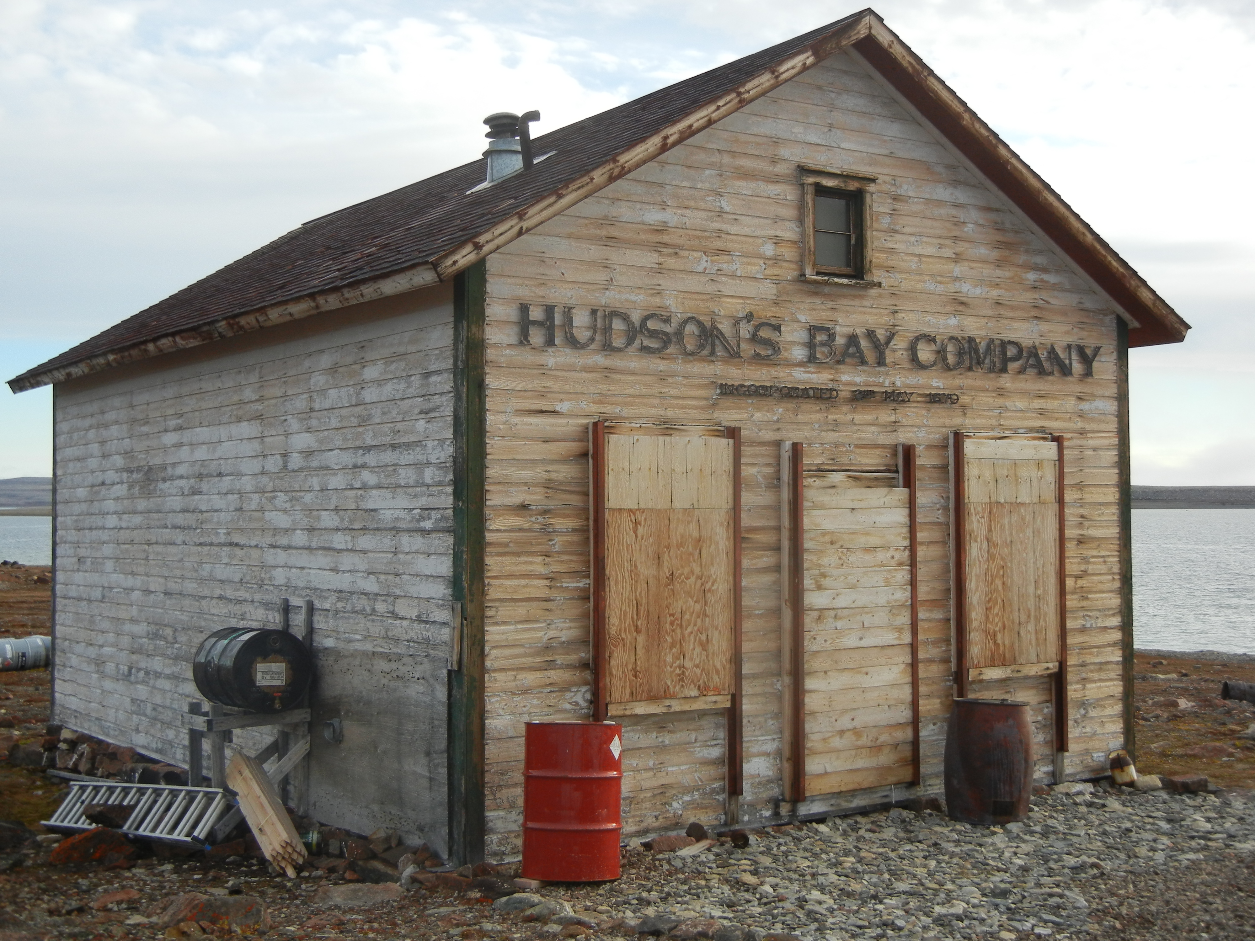
Back to Fort Ross.
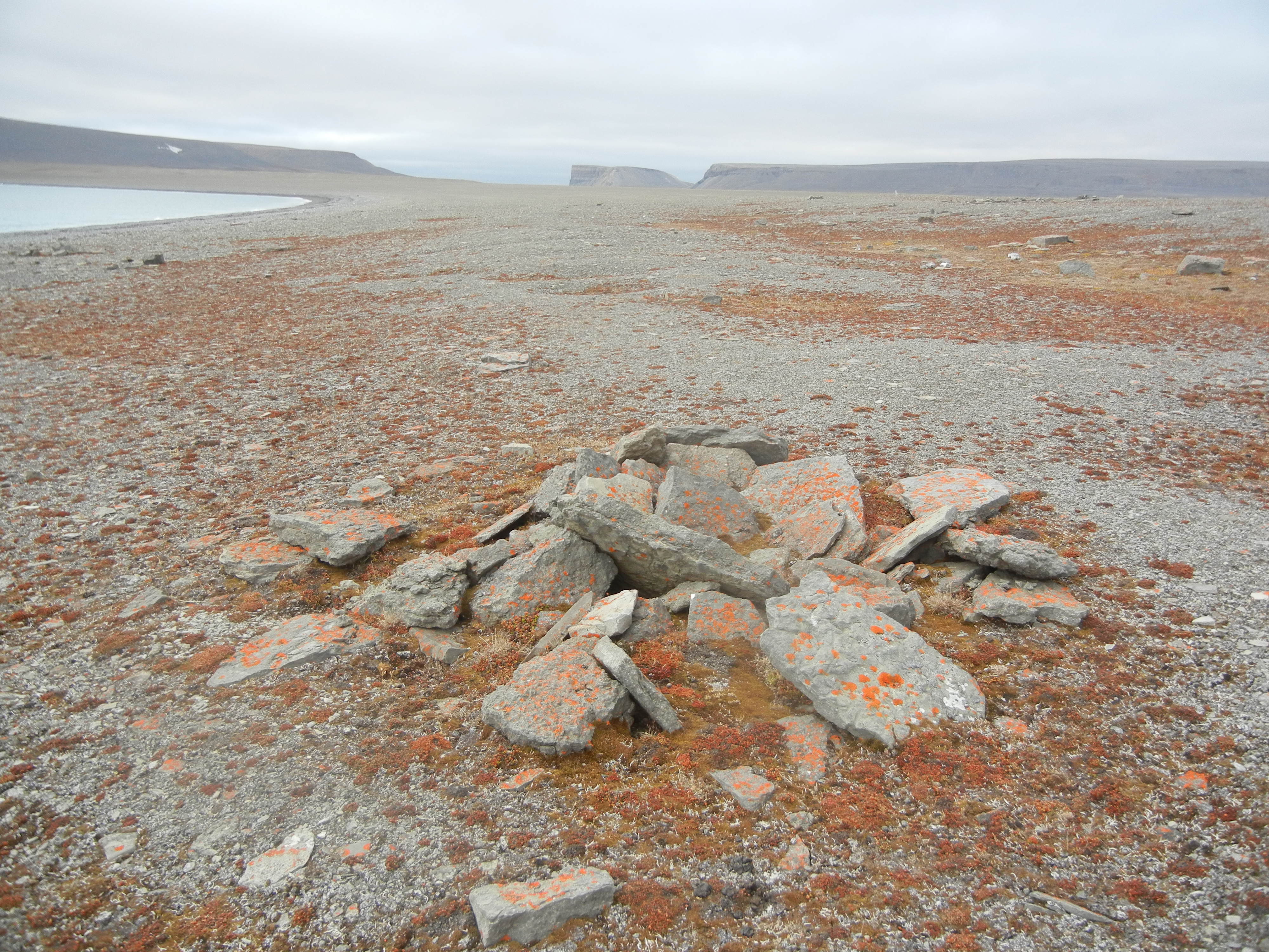
This site was also used by McClintock as his wintering site during his Franklin search expedition of 1857. A family memorial is also at this site. In 1937 the Hudson’s Bay Company set up a trading post and made the first vessel transit of Bellot Strait. The trading post lasted for 11 years, after some Inuit were unsuccessfully forcibly relocated here. Inuit people used the area for hunting, and their meat caches and tent rings dot the site, Inuit still use one of the Hudson’s Bay huts for hunting caribou and musk ox.
Johansen Bay
Day 13:
Wet landing and walking
Day 14: Gjoa Haven
A nice and friendly small town named after Amundsen’s boat, the ‘Gjoa’. He had spent two winters learning the customs and skills of the Inuits. He became very friendly and close to the inhabitants, and went on to be the first man to sail through the NW Passage.
Day 15: Cambridge Bay:
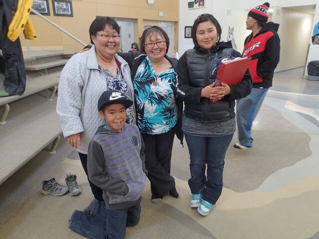
Another day, another Bay, another beautiful village greets us as we go ashore, More colourful people going about their business and who are willing to show us around and answer our many questions, and put on a cultural show or display for us.
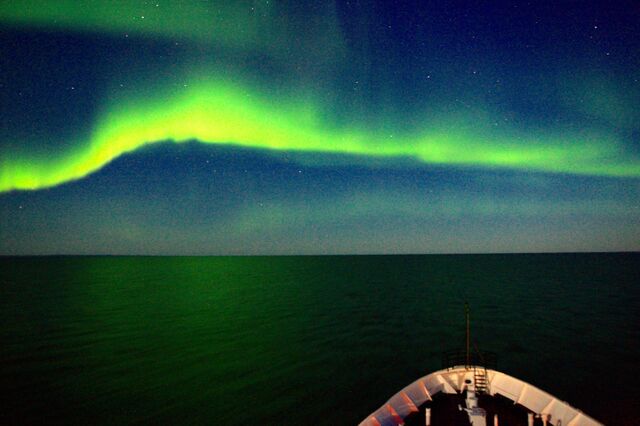
We have been moving further south for the last few days and the nights are getting much darker. We are becoming optimistic about seeing some aurors appearing over the north polar areas. Well it happened around midnight. A call from the bridge woke us all from our slumbers for Aurora Borealis.
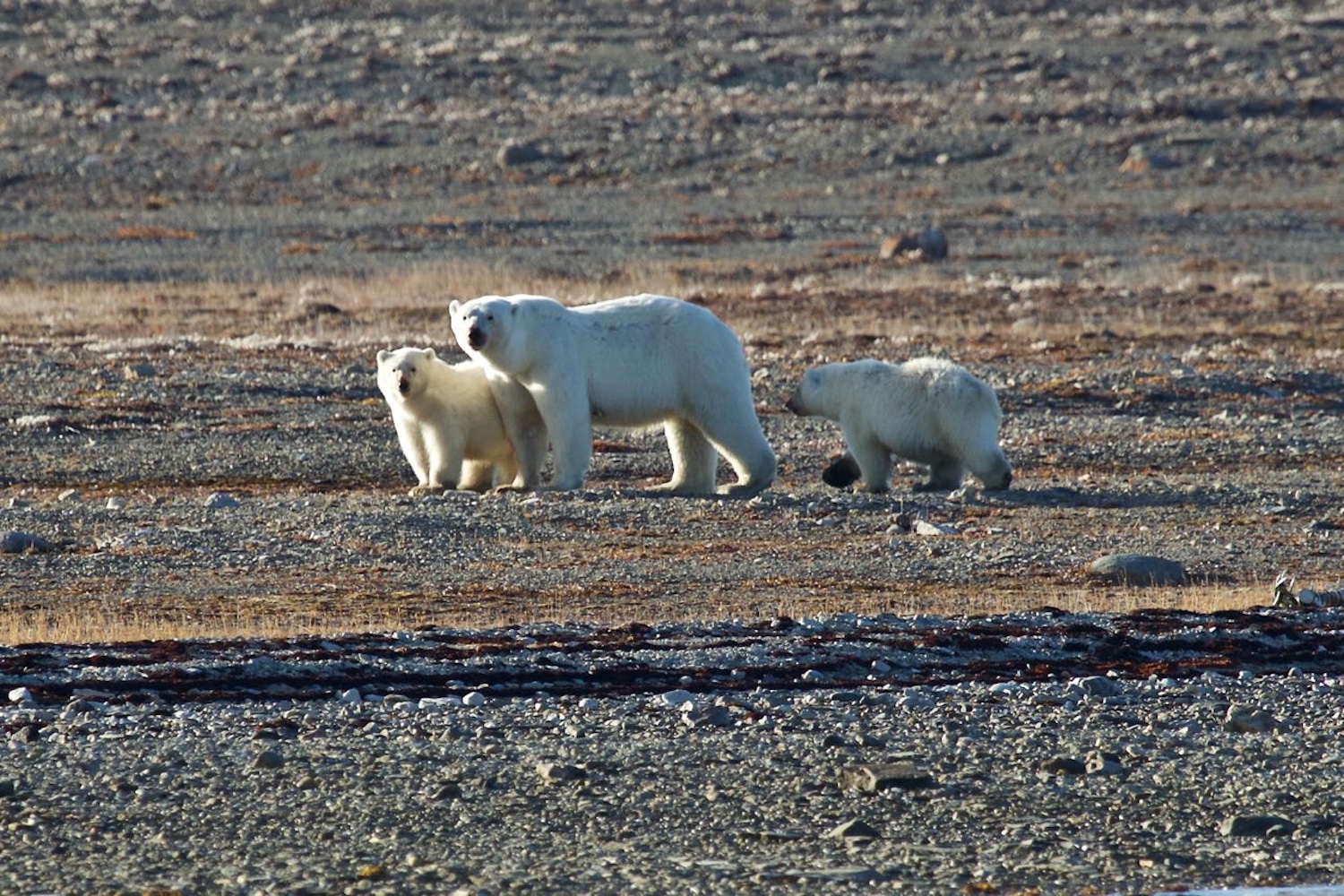
And there are still some bears around.
We sail on through Johansen Bay where we sight a Grizzly Bear on shore, most unexpedly, along with three wolves in the same area. I don’t know who was chasing who. We sailed on into Amundsen Gulf to complete the passage and then turn around the final few miles sail to Kuglugtuk where our magnificent expedition ends.
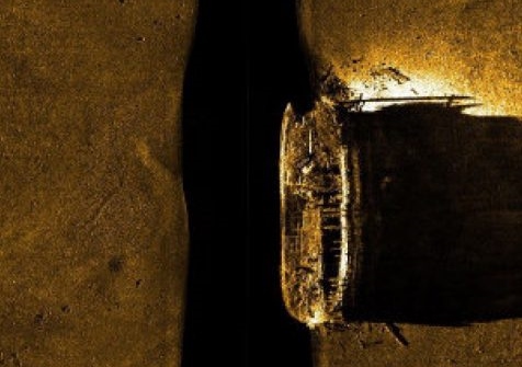
In September 2014 the hull of HMS Erebus was found on the southern end of of King William Island. The Canadian Coast Guard continue to search for HMS Terror.